When the multicolored image loaded onto his computer screen, Jordan Cole tried to temper his excitement. The deep blue area was the right shape, the right size, in the right location. But he couldn’t have found the outline of the 1760s Halifax Courthouse so quickly. It’s never that easy. He stared at the image for a couple of minutes, and his certainty solidified. He turned to his colleague and said, “I think you should look at this.”
Carl Burke (left) and Frank McMahon used a 1769 map of the town to help archaeologists find the location of the colonial Halifax Courthouse. photograph by Chris Rogers
The North Carolina Office of State Archaeology had contracted New South Associates, where Cole works as a geophysical specialist, to find the location of Halifax’s original courthouse in 2022, after previous attempts to locate it had been unsuccessful. When a new courthouse was built in 1849, the old building was demolished so completely that, for generations, no obvious evidence of it remained.
The original courthouse holds historical significance to the state, and to the country as a whole, because, on April 12, 1776, the Fourth Provincial Congress adopted the Halifax Resolves here — the first official action by any colony calling for independence from Britain. Later, the first public reading in North Carolina of the Declaration of Independence happened in front of the building, and the state’s first constitution was drafted here, too.
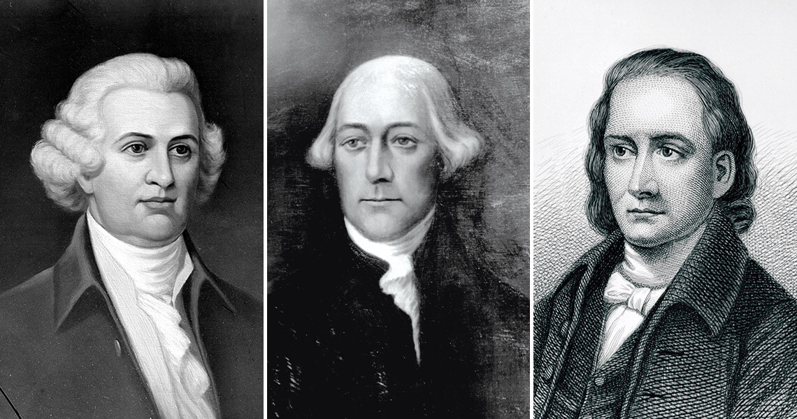
William Hooper, Joseph Hewes, John Penn Photography courtesy of State Archives of North Carolina
The 83 delegates present on April 12 unanimously adopted the resolves, which directed recommendations for independence to the Continental Congress. At the meeting in Philadelphia a month later, Joseph Hewes, one of North Carolina’s delegates, presented the Halifax Resolves to the Continental Congress. Hewes became one of North Carolina’s signers of the Declaration of Independence, along with William Hooper and John Penn. We’ll never know for certain, but it’s possible that, without the Halifax Resolves, we wouldn’t be celebrating the country’s semiquincentennial this year.
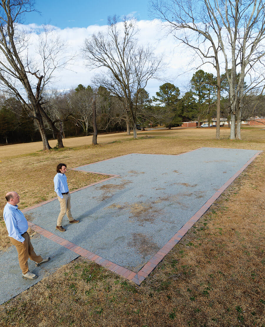
This April, Halifax will commemorate the 250th anniversary of the drafting of the resolves with speakers, reenactments, a concert, and a wreath-laying ceremony. Much of the programming will take place near the site of the original courthouse, which is now outlined in brick and filled in with gravel. “One of the reasons that we wanted to find [the courthouse] was because people are always asking for something tangible that’s connected to the Halifax Resolves,” says Frank McMahon, assistant site manager at Historic Halifax. “To find the courthouse is a direct connection.”
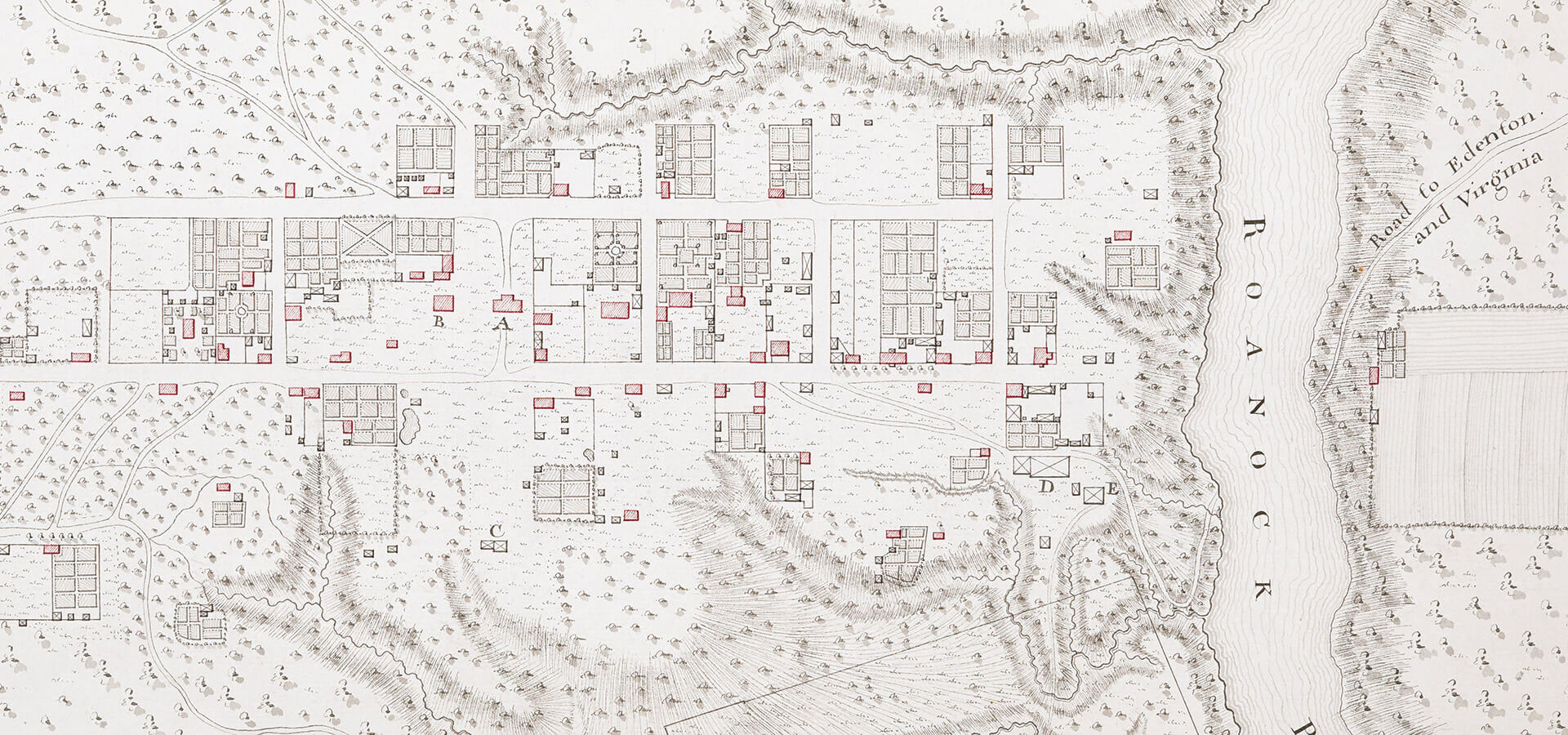
People have been looking for the courthouse since the 1960s, when archaeologist Stanley South did an excavation here. South used a 1769 map by French cartographer Claude Sauthier to locate his dig site. Sauthier created several maps of notable North Carolina colonial towns, and his maps were “scary accurate,” says Samantha Taylor, a former New South Associates senior archaeologist. But South misinterpreted the map, mistaking an existing 1836 jail for the original, demolished jail that Sauthier had plotted. So, though he dug directly on the courthouse site, he didn’t realize what he had found.
In the 1970s, archaeologist Stuart Schwartz briefly looked for the courthouse site but concluded that, due to soil erosion, all evidence of the footprint had likely been lost.
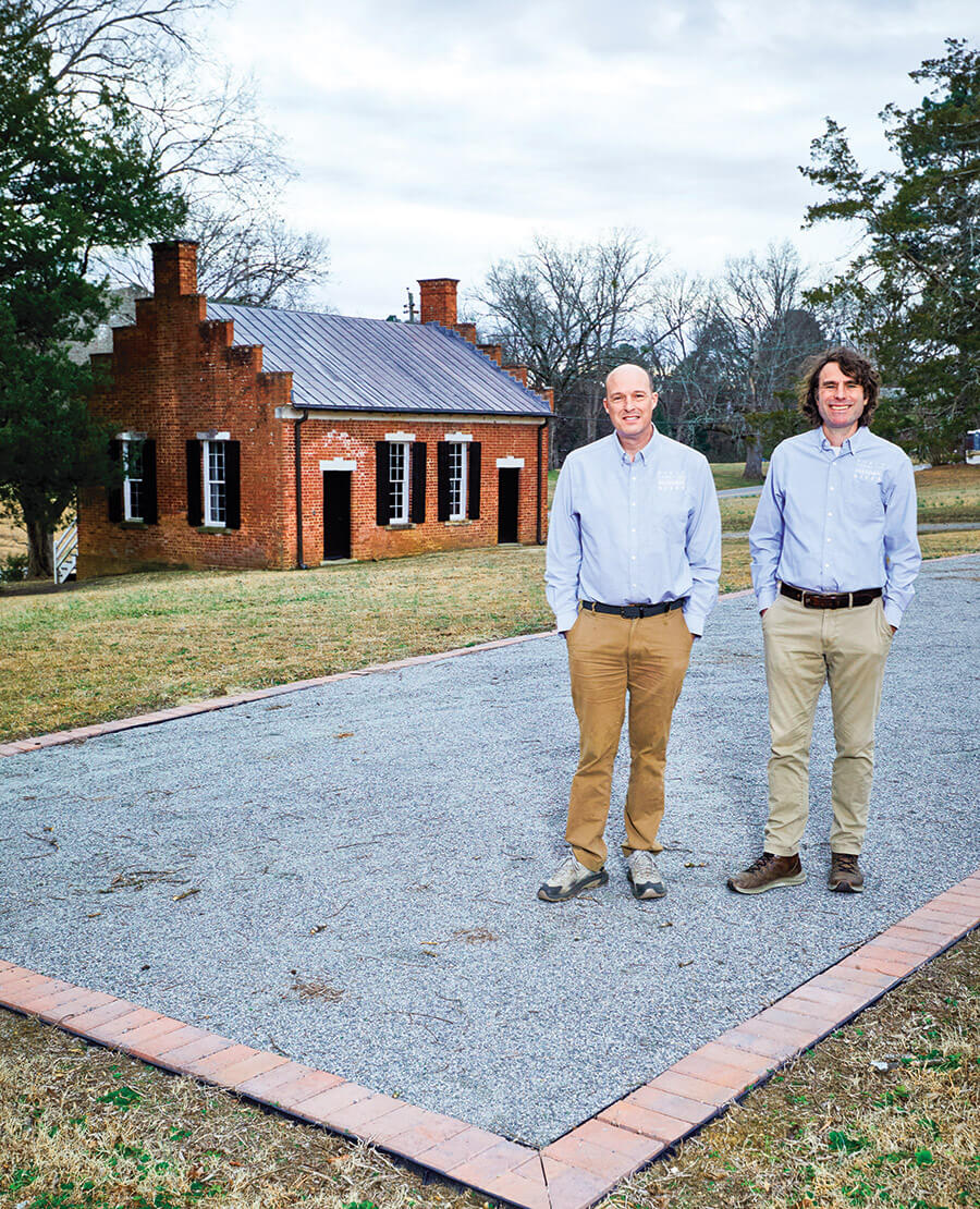
Burke and McMahon stand on the site of the colonial Halifax Courthouse. photograph by Chris Rogers
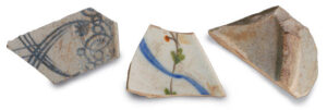
In 2018, David Cranford joined the Office of State Archaeology and was tasked with finding ways to engage the public. So he set up a public dig site at Halifax and coordinated with ECU graduate student Matt Harrup to perform a survey using ground-penetrating radar (GPR), a method that uses radio wave pulses to create an image of the subsurface. The technology was first used in archaeology in the 1970s but had only recently begun to be commonly used in archaeological studies. Harrup’s results were mixed. Cranford’s team uncovered some artifacts — ceramics, pipe stems, a gunflint — but nothing that would determine the courthouse location. They didn’t even know if they were looking in the right area.
Then, in 2022, the Office of State Archaeology approached McMahon and Historic Halifax Site Manager Carl Burke with a proposal to engage an archaeological firm to survey the site using GPR yet again. And this time, Burke and McMahon knew exactly where to look. Using the 1769 Sauthier map and a tape measure, the pair determined what they thought to be the correct location. Cole brought the GPR machine and wheeled it meticulously back and forth over the designated spot in straight, parallel lines. “And they found it!” McMahon says.
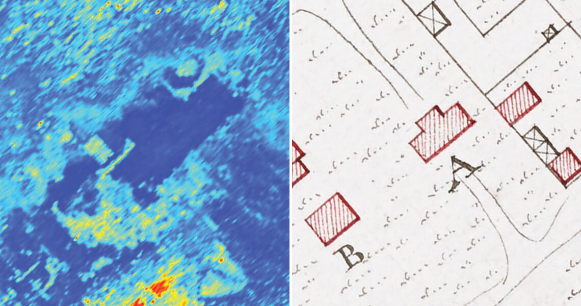
Ground-penetrating radar revealed the outline of the Halifax Courthouse, which matched the size, shape, and location of the courthouse drawn on Claude Sauthier’s 1769 map of the town. photograph by Norman B. Leventhal Map & Education Center at the Boston Public Library; New South Associates
The GPR image of the site shows a dark blue T-shape surrounded by areas of lighter blue, yellow, red, and green. The dark blue is a “negative” — it shows the area that was protected from traffic while the courthouse was in place, where the soil is less compressed. The brighter colors around the T-shape depict soil compaction from pedestrians and horses during the time that the building was in use.
When Cole saw the crystal-clear image, he couldn’t believe it.
“Usually, when we’re looking for buildings, especially this old, reflections can be quite difficult to discern,” he says. “But this was really quite spectacular. As soon as we were able to put all the profiles together and produce a 3D image, it was immediately obvious that we had found the courthouse like that,” he says, snapping his fingers.
“[The courthouse] was a community hub,” David Cranford says. “By doing controlled excavations, we can recover [artifacts] to interpret the kinds of activities that were going on in this place.” photograph by New South Associates
After six decades of unsuccessful attempts, Cranford, Burke, and McMahon couldn’t believe it, either.
“It really blew my mind,” Cranford says.
For Burke, it was a sense of confirmation. “And after studying it and looking at it and thinking about it and coming out here and measuring and thinking that it ought to be right about here, it just was very redeeming,” he says “It was just one of those moments of completeness.”
Today, you can stand in the very spot where the Halifax Resolves were most likely drafted, imagining what it would have been like when 83 delegates crowded into the small building to adopt the resolution. You can tour 18th-century buildings such as the Eagle Tavern and the Tap Room, which open a window onto Revolutionary War life. You can walk the very ground where the Declaration of Independence was first read aloud in North Carolina, picturing the day revolutionary leader Cornelius Harnett unrolled the document in front of the courthouse to a jubilant yet reverent crowd. You can almost hear the shouts of joy when he finished.
“Even though the building is not there anymore because it’s been auctioned off, to go visit that actual location where these things took place is powerful,” McMahon says.
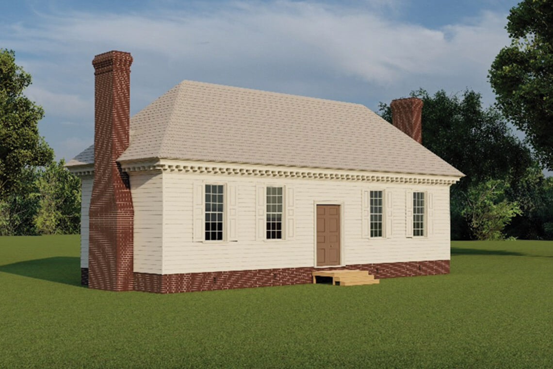
Burke and McMahon worked with architectural historians to create a drawing of what the Halifax Courthouse might have looked like. Photography courtesy of MCWB Architects
But without the visible outline of the courthouse that’s on the site now, visitors wouldn’t know the significance of this place. They wouldn’t know when they’re standing in the footsteps of our forefathers — the founding fathers of our country.
“I think finding [the courthouse] and celebrating it and sharing that narrative with the public instills a lot of pride in one’s country and pride in one’s state,” Taylor says. “It’s a very important symbol to remind people that North Carolina was part of this early movement to secede and rebel. It emphasizes that North Carolina has this often untold or forgotten significance to that narrative of freedom.”
And here is where it all began.