Put ramekins on a baking sheet. Bake for 25-35 minutes, until puffed and golden. Remove from oven, and let stand for 5 minutes. With a flexible spatula, remove strata to
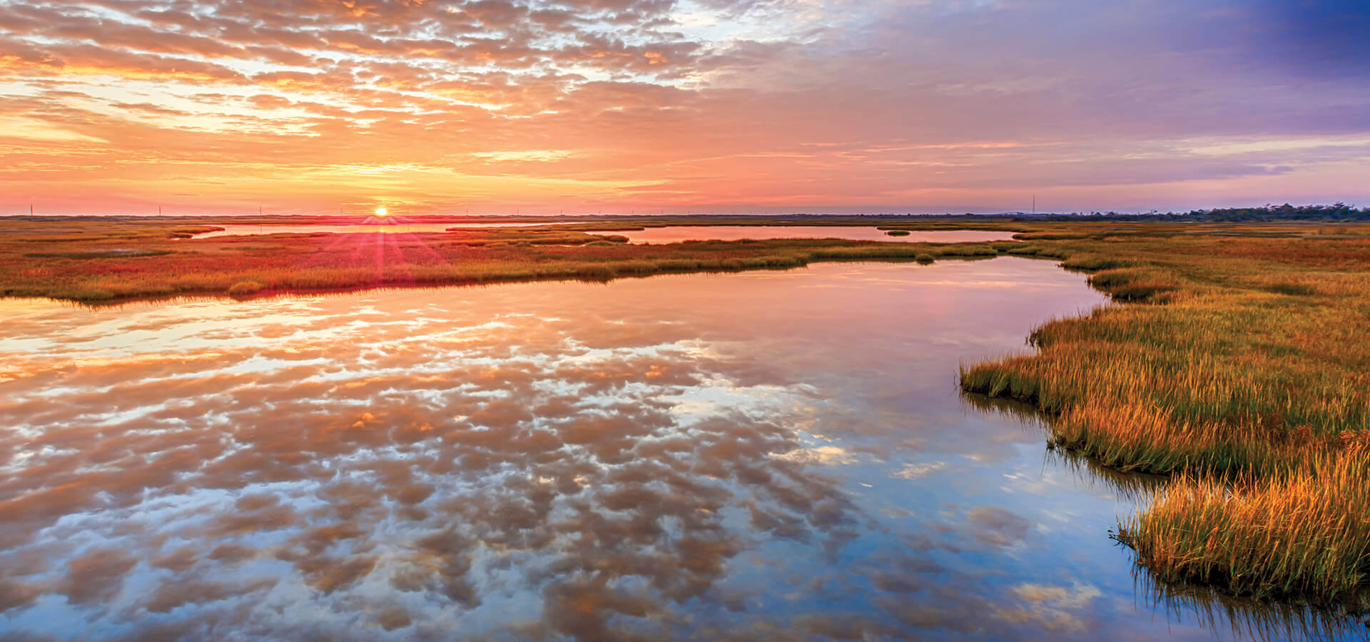
[caption id="attachment_211132" align="aligncenter" width="1140"] Tidal creeks meander through pockets of marsh dotting Banks Channel — the waterway separating Wrightsville Beach and mainland Wilmington — first identified on maps in 1892.[/caption]
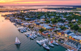
[caption id="attachment_211132" align="aligncenter" width="1140"] Tidal creeks meander through pockets of marsh dotting Banks Channel — the waterway separating Wrightsville Beach and mainland Wilmington — first identified on maps in 1892.[/caption]
From the expanses of needlerush at Cedar Island to the lush spartina feathering the shores of Bodie and Roanoke islands, our salt marshes are the threshold to a watery world — the heartbeat of our coastal ecosystem.
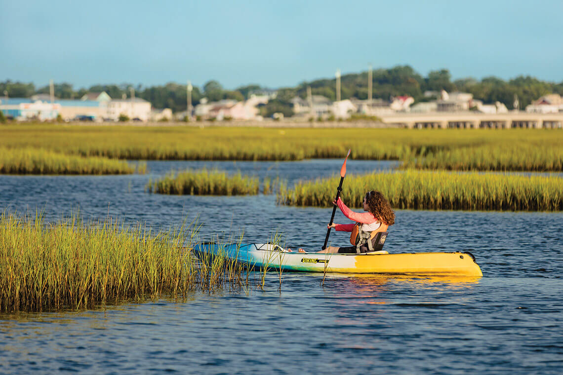
Tidal creeks meander through pockets of marsh dotting Banks Channel — the waterway separating Wrightsville Beach and mainland Wilmington — first identified on maps in 1892. photograph by David Garrison/iStock/Getty Images Plus
Wrightsville Beach
In this intertidal world, narrow, winding creeks rise and fall at the predictable whim of the tide. Twice daily, a silent encroachment of water from the inlet swells these arteries, and the marsh succumbs to the tide’s watery weight, drinking in its cocktail of Atlantic salt and river minerals.
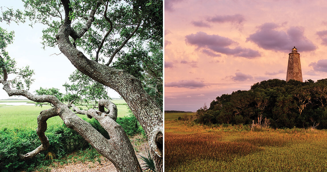
Old Baldy, North Carolina’s oldest surviving lighthouse, stands guard over a marsh that began forming some 12,000 years ago. photograph by Matt Ray Photography, David Blevins
Bald Head Island
The mats of peat and fields of spartina that hug the backsides of our barrier islands are more than scenic habitats and recreational havens. Salt marshes help stabilize these islands by slowing the flow of water, thus reducing erosion along the shoreline. Maritime forests, like the nearly 200-acre tangle of live oaks and cedars in Bald Head Woods Reserve, act as a wind buffer, further fortifying the veil between sand and water.
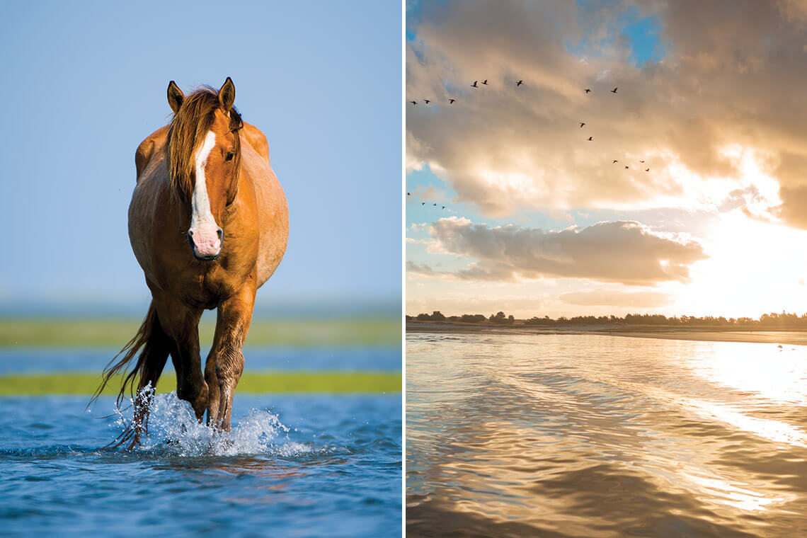
In her first book, Under the Sea-Wind, Rachel Carson explores Back Sound’s tidal marsh through its birds, fish, and crabs. Today, the reserve is also home to an iconic herd of wild horses introduced in the 1940s, kin to the Shackleford Banks herd (left) across Back Sound. photograph by Jared Lloyd, Baxter Miller
Rachel Carson’s Muse
In 1938, a young marine biologist hired by the U.S. Bureau of Fisheries arrived in Beaufort. The landscape shaped by constant change in turn shaped Rachel Carson’s own course. Carrot Island, Bird Shoal, Town Marsh, and Horse Island — now part of the 2,315-acre reserve that bears her name — along with neighboring Shackleford Banks, became Carson’s muse, their ecology guiding her toward becoming one of the nation’s most consequential writers and leaders of the modern environmental movement.
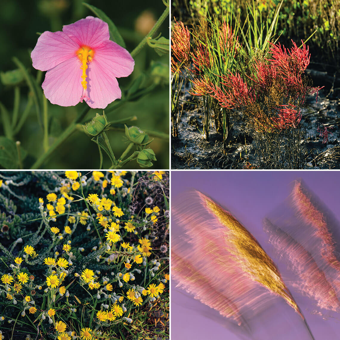
Clockwise from top left: saltmarsh mallow, glasswort, American common reed, camphor weed. photograph by David Blevins, Baxter Miller
Flora of the Marsh
In spring, the marsh’s dormant vegetation turns from brown to chartreuse to emerald. From summer to fall, this patchwork of green is punctuated with the salt-adapted bubblegum-pink blooms of mallows, a haze of sea lavender, and cascades of seaside goldenrod.
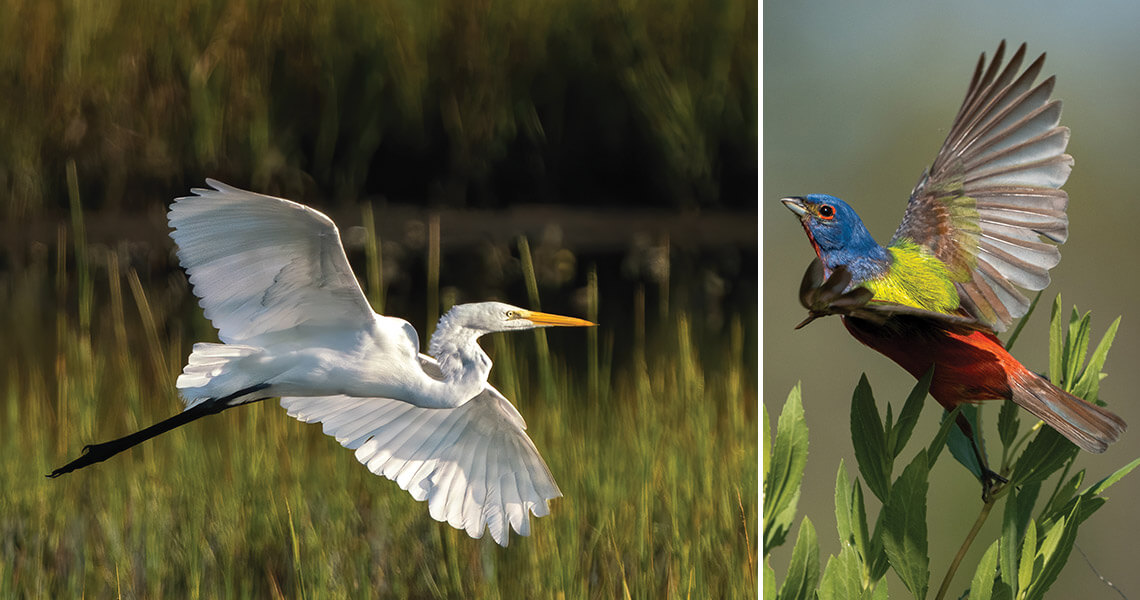
The unmistakable plumage of the male Eastern painted bunting (right) is a welcome sign of spring. A rare sight, their purple-indigo heads, neon-lime backs, and ruby chests and bellies are an unforgettable splash of color against the open salt marshes along the central and southern coasts. photograph by John Mauser
Along the Flyway
Around the middle of the Atlantic Flyway, our state’s 220,000 acres of salt marshes support an abundance of both migratory birds and year-round residents. Graceful shorebirds, prized waterfowl, and delightful songbirds find a protected place to rest and easy access to plentiful and diverse food sources.
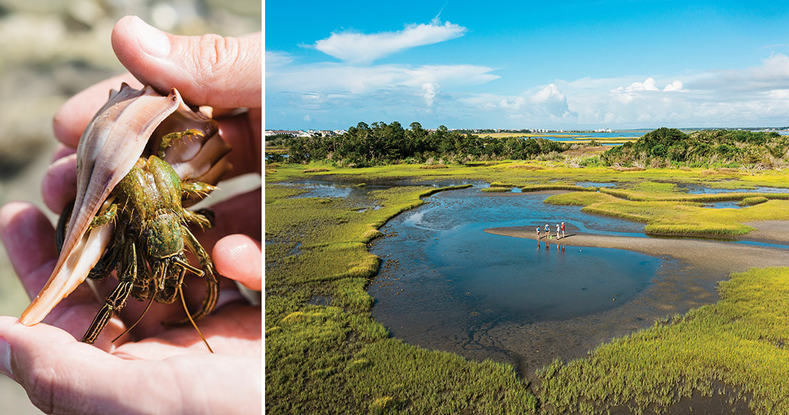
The plants and animals of a salt marsh reveal much about the health of the ecosystem. Indicator species like hermit crabs, with their soft bodies and borrowed shells, are sensitive to changes in water quality and toxins and will disappear from harmful habitats. photograph by Matt Ray Photography
Surf City
The vestibule and egress of our Coastal Plain, salt marshes are both buffers from storms and filters for runoff. Globally, they play an important role in mitigating the impact of climate change by removing carbon 10 times faster and storing three to five times as much of the gas as mature tropical forests.
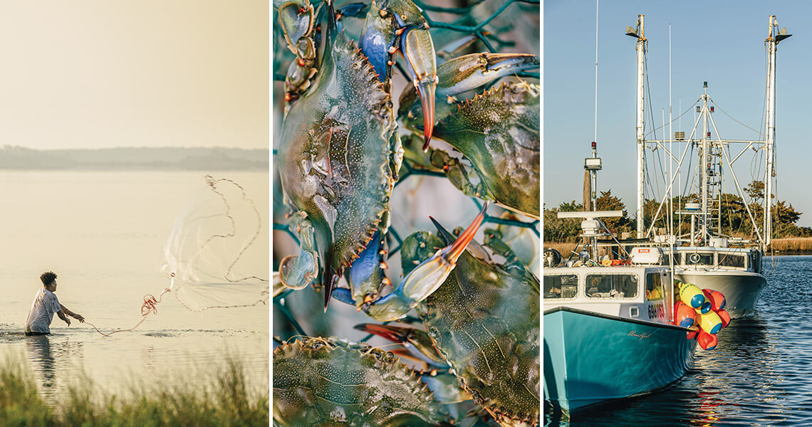
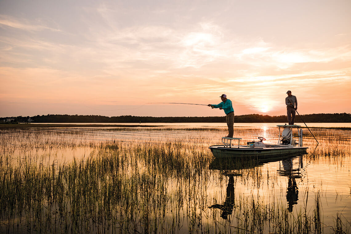
The strength of North Carolina’s fisheries begins with its estuaries. Clean water and protected wetlands sustain spawning grounds and juvenile habitats that support the cultural and economic vitality of fishing communities up and down our coast. photograph by Baxter Miller
Where the Fishery Begins
Among the most productive ecosystems in the world, North Carolina’s marshes, mudflats, and sounds function as essential nursery grounds for the state’s fisheries. Nearly 90 percent of commercially and 60 percent of recreationally important fish, shellfish, shrimp, and crabs depend on these estuaries at some stage of their lives.
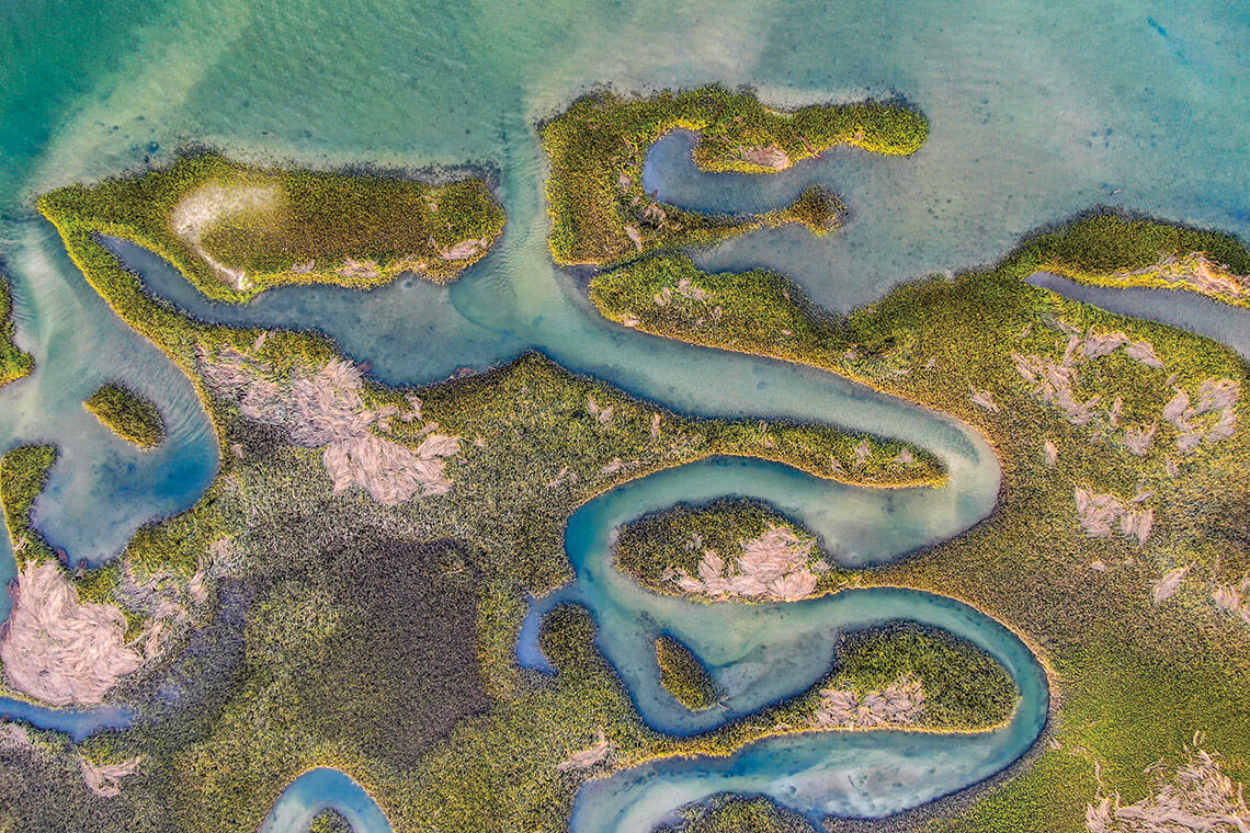
By kayak, the maze of narrow creeks and grass-lined coves offers chance encounters with curious bottlenose dolphins, up-close meetings with wading shorebirds, and hidden moments for quiet reflection. photograph by Baxter Miller
Swansboro
Among Swansboro’s waterfront, Bear Island, and Hammocks Beach State Park, a network of fragmented marshlands laces together a landscape ideal for slowing down and exploring at water level. This stretch of coast is the only place in the world to catch a glimpse of the crystal skipper butterfly, its 30-mile range confined to a narrow band between here and Fort Macon.
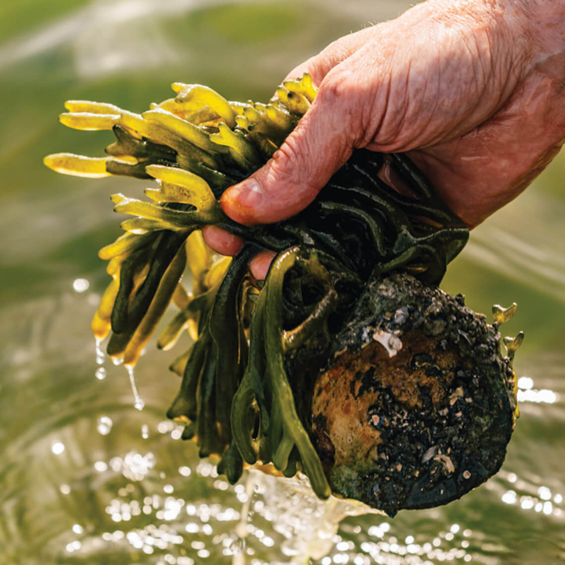
Our salt marshes hold an abundance of plant and animal life, like dead man’s fingers, …<br><span class="photographer">photograph by Baxter Miller</span>
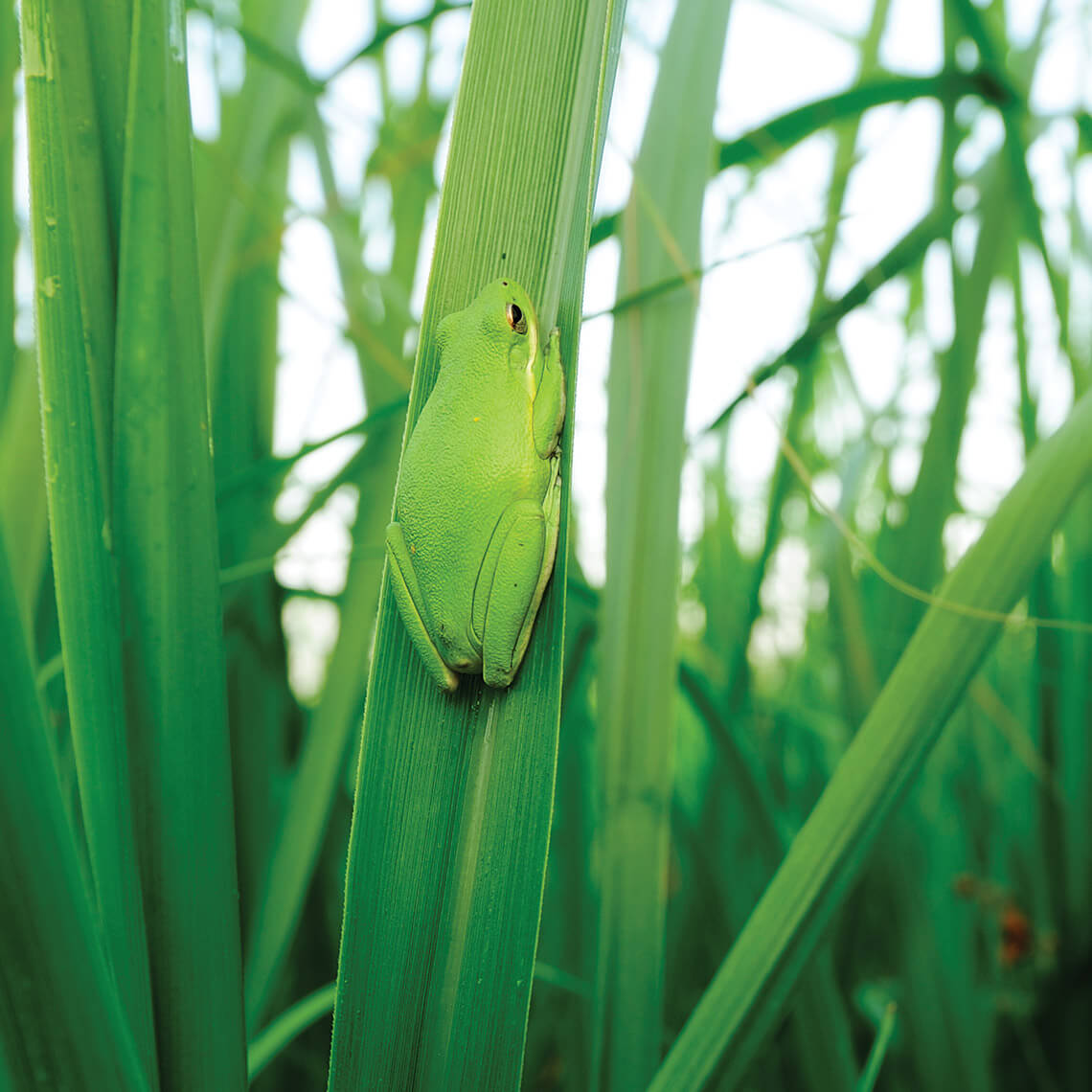
… American green tree frog, …<br><span class="photographer">photograph by David Blevins</span>
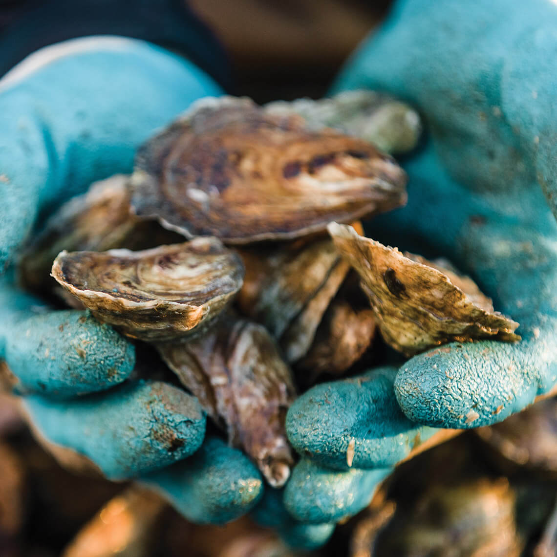
… oysters, …<br><span class="photographer">photograph by Baxter Miller</span>
… and fiddlers crabs.<br><span class="photographer">photograph by Baxter Miller</span>
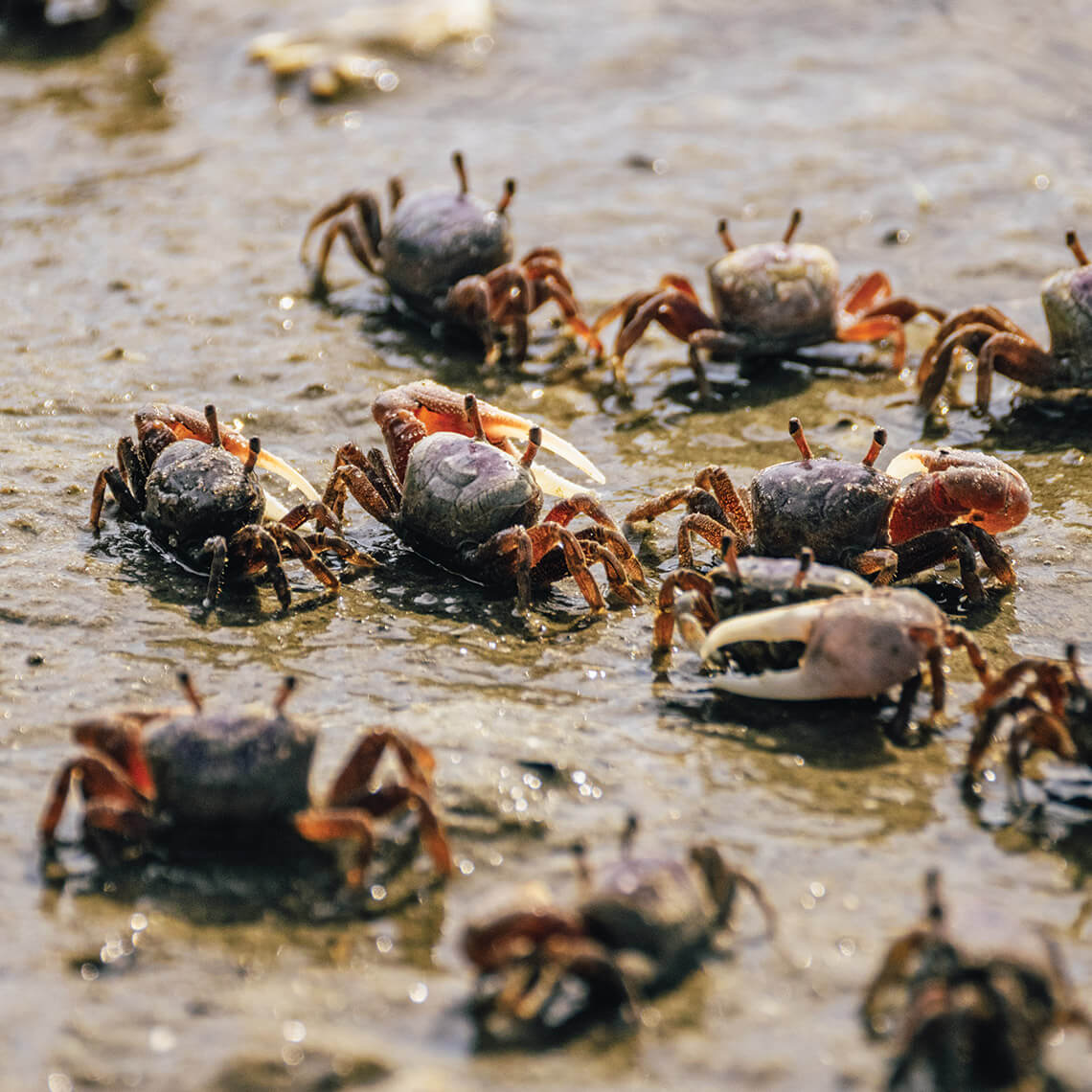
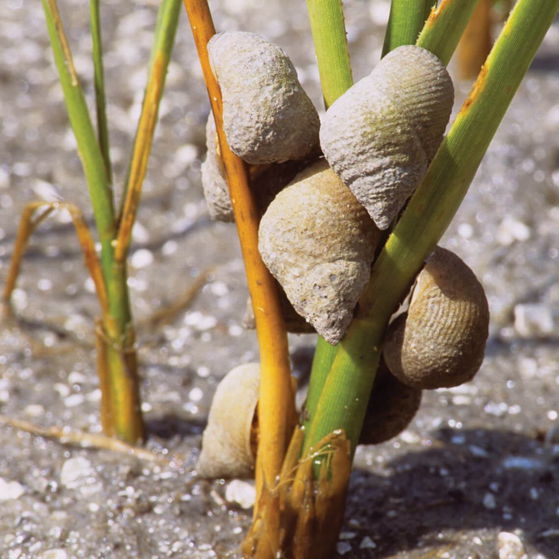
Marsh periwinkles follow the tide’s rhythm — dipping below the waterline to lay eggs and climbing above it to evade predators. They etch grooves into the grasses they call home, seeding them with waste to cultivate the very fungus on which they feed.<br><span class="photographer">photograph by David Blevins</span>
Life Between Tides
At ebb tide, the marsh opens, and an ephemeral kingdom is revealed. Hordes of fiddler crabs emerge from their burrows, tossing aside plugs of mud that guard their bunkers. Periwinkles descend their rostrum, safe from hungry crabs that proliferate on the flood tide. And, as the water recedes, beds of oysters begin their percussion, snapping shut in succession and sending spurts of water skyward. In this twice daily unfolding, a fragile balance holds, bound by water and time.
The Cape Fear Estuary is home to the only river in our state that dumps directly into the Atlantic. The blackwater Cape Fear lacks the protection that a large sound affords all others in the state, allowing saltwater to move farther inland. photograph by Matt Ray Photography
A Place of Wonder & Beauty
To stand on the shore of a salt marsh as the sun gilds the tips of needlerush; to cast a line from the bow of a skiff into a narrow, mirrored clearing between blades of grass; to cross the Monroe Gaskill Memorial Bridge at sunset, spanning the patchwork meadow of Thorofare Bay — is to marvel at the essential meeting place of land and water. Subject to the forces of both nature and man, it endures — protector of the mainland, cradle of the estuary, and foundation for life beyond it.
This story was published on May 22, 2026
Get our most popular weekly newsletter: This is NC
At both the turn of the century and today, Beaufort’s waterfront has attracted a hum of commerce and community. At its heart, a historic avenue tells that history, from the stately double-porched homes to the sound of ships announcing their arrival at port.