Tucked within the peaceful Blue Ridge Mountains — almost as far west as you can go before crossing into Tennessee — lies a place with more trees than people. It’s a place with extraordinary vistas; winding ribbons of road and hiking trails; covered wagons, yurts, tree houses, and historic lodges to lay your head; and fishing that draws anglers from around the world.
Whether you’re planning a quick fall getaway or an extended mountain escape to stay at one of the unique accommodation options, look to Graham County as a destination with enough crisp autumn air to fill your lungs and refresh your soul. It’s an easy drive from Asheville, Atlanta, Greenville, and Knoxville, but once you’ve arrived, you’re a world away. Read on for our tips on finding a bit of quiet and a gorgeous view, where you can send your worries off on an Appalachian breeze.
A Walk in the Woods
Graham County offers plenty of opportunity for hikers of various abilities, whether you prefer steep terrain or a leisurely stroll. The county is home to the quieter side of the Great Smoky Mountains National Park, consistently the most visited park in the National Park system.
While millions of visitors head to the Tennessee side every year, if it’s solitude you want, you’re in luck: North Carolina sees a small fraction of that foot traffic, making the park’s miles of trails perfect for a hiker who wants to get lost in their thoughts while staying on the path. Enter the park through the Twentymile Trail trailhead at the Ranger Station on NC Highway 28.
For an easy hike with a beautiful view, head to Santeetlah Lake, created when the Santeetlah Dam was built in the 1920s. Most of the shoreline is public forest, and the lake is bordered by the wide, flat Santeetlah Lake Trail — nearly 7 miles of paths perfect for hikers of all ages and speed, especially families walking together. It’s also an ideal trail for mountain bikers and horseback riders.

For an easy hike with a beautiful view, head to Santeetlah Lake. photograph by David Hunter Turner, Little River Creative
Just a few miles east of Lake Santeetlah, Joyce Kilmer Memorial Forest is considered a jewel of the county and is home to flora from the original Appalachian Forest, a 3,800-acre old-growth forest. The only way to explore it is on foot. Do so with care; some of the trees are more than 450 years old.
You’re probably familiar with the Appalachian Trail, the longest hiking-only footpath in the world, which runs from Georgia to Maine. If you want to experience a beautiful section of the AT, strap on your hiking boots at Fontana Village Resort and Marina; you can join the trail across the road from the marina and hike about 3.5 miles to Fontana Dam, a destination in and of itself.
Built by the Tennessee Valley Authority during World War II to answer the growing need for hydroelectric power (work began on it three days after the Pearl Harbor attacks), construction of Fontana Dam created Fontana Lake, the largest lake in western North Carolina and a popular place for house boats, fishing, and other aquatic pursuits. At the top of the dam — the tallest in the eastern U.S. — stop for a while and take in the breathtaking view: At 480 feet up, it’s the equivalent of a 50-story skyscraper. If the lake is at its lowest levels, take a moment to look for lingering signs of Judson, the town at the bottom of Fontana Lake which was sold and submerged when the valley was flooded.
Farther east, off NC Highway 28, is the Tsali Recreation Area, where you’ll find four loops of hiking and biking trails and campsites open from April to October. Mountain bikers come from all over to experience the challenging hard-packed, single-track courses that range from a fast 7.3 to 14 miles long. The trails wind along the lake shore and offer views of Fontana Lake and Great Smoky Mountains National Park. Horses are also welcome, but bikers and equestrians must follow alternating days (check out the trail schedule on their website). From Tsali, you can also access a public boat ramp to Fontana Lake.
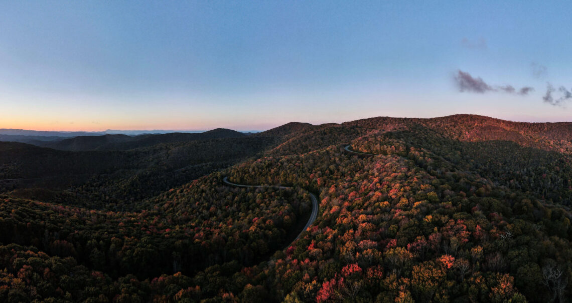
The Cherohala Skyway — and Other Asphalt Adventures
Of course, you don’t have to disappear into the woods to find some peace and quiet. For 25 years, motorists have enjoyed the views, overlooks, and twists and turns of the Cherohala Skyway, a 43-mile National Scenic Byway that stretches from Robbinsville to Tellico Plains, Tennessee. For leaf peepers, there’s no better vantage point of fall color via vehicle — some overlooks even offer special colorblind viewfinders to help more visitors experience autumn’s vibrant reds, oranges, and yellows. Other overlooks feature interpretive maps and stations that tell stories about the area’s culture and history. Take note, there are no facilities on the skyway, so make sure you’re stocked with fuel and a picnic to enjoy.
If you want to stretch your legs, park your car at Mile Marker 8 to access the Huckleberry Knob trailhead. This is a 2.5-mile hike with a huge payoff: a 360-degree view from the highest point in Graham County. In early fall, it’s a fantastic place to witness the monarch butterfly migration.
But for sheer exhilaration, nothing beats the Tail of the Dragon, otherwise known as U.S. Highway 129, which starts in Robbinsville and twists and turns its way into Tennessee. The attraction isn’t the scenery — it’s the road itself and its 318 curves over a scant 11 miles. Keep your eyes on the asphalt and look out for tricky turns with names like Copperhead Corner and Hog Pen Bend.
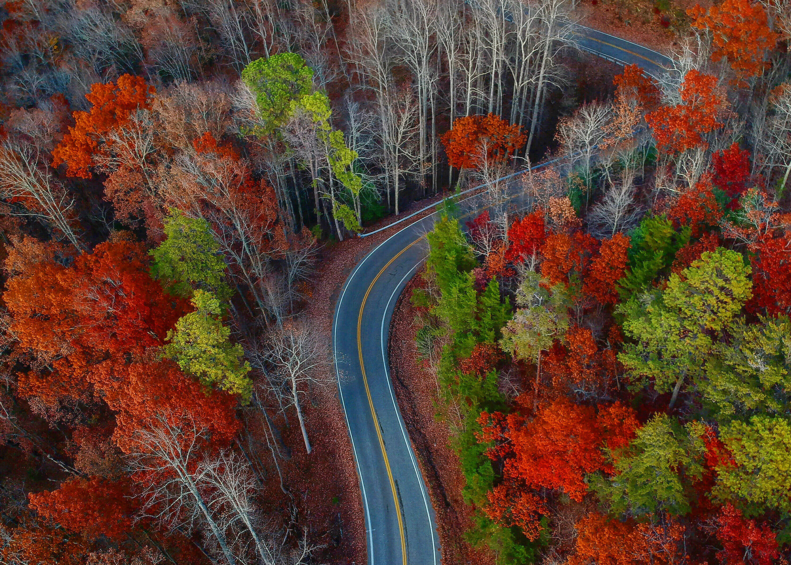
Get your adrenaline pumping on the Tail of the Dragon, otherwise known as U.S. Highway 129. photograph by David Hunter Turner, Little River Creative
Healing Waters
Solitude exists on the water, and both Lake Santeetlah and Fontana Lake have numerous places to put in for a day of boating, kayaking, and canoeing. Santeetlah in particular is a beautiful and calm lake to paddle board or kayak, and you can choose from plenty of campsites around the lake if you want to sleep under the stars.
If you’re looking for a faster pace, run some class IV-V whitewater rapids on the Cheoah River between Santeetlah Dam and the Calderwood Lake Boat Launch. (The rapids are created via dam release, so check the American Whitewater website for a schedule.)
With its cold, clear creeks and lack of crowds, Graham County is a trout-fishing paradise. The county has miles of fishable streams, some only accessible by hiking. In particular, Big Snowbird Creek holds brook, rainbow, and brown trout, and its delayed harvest, which begins October 1, is some of the most sought-after fishing in the state. Sport fishermen come from around the state to test their fly-fishing skills with artificial bait in the hopes that a fish or two will rise.
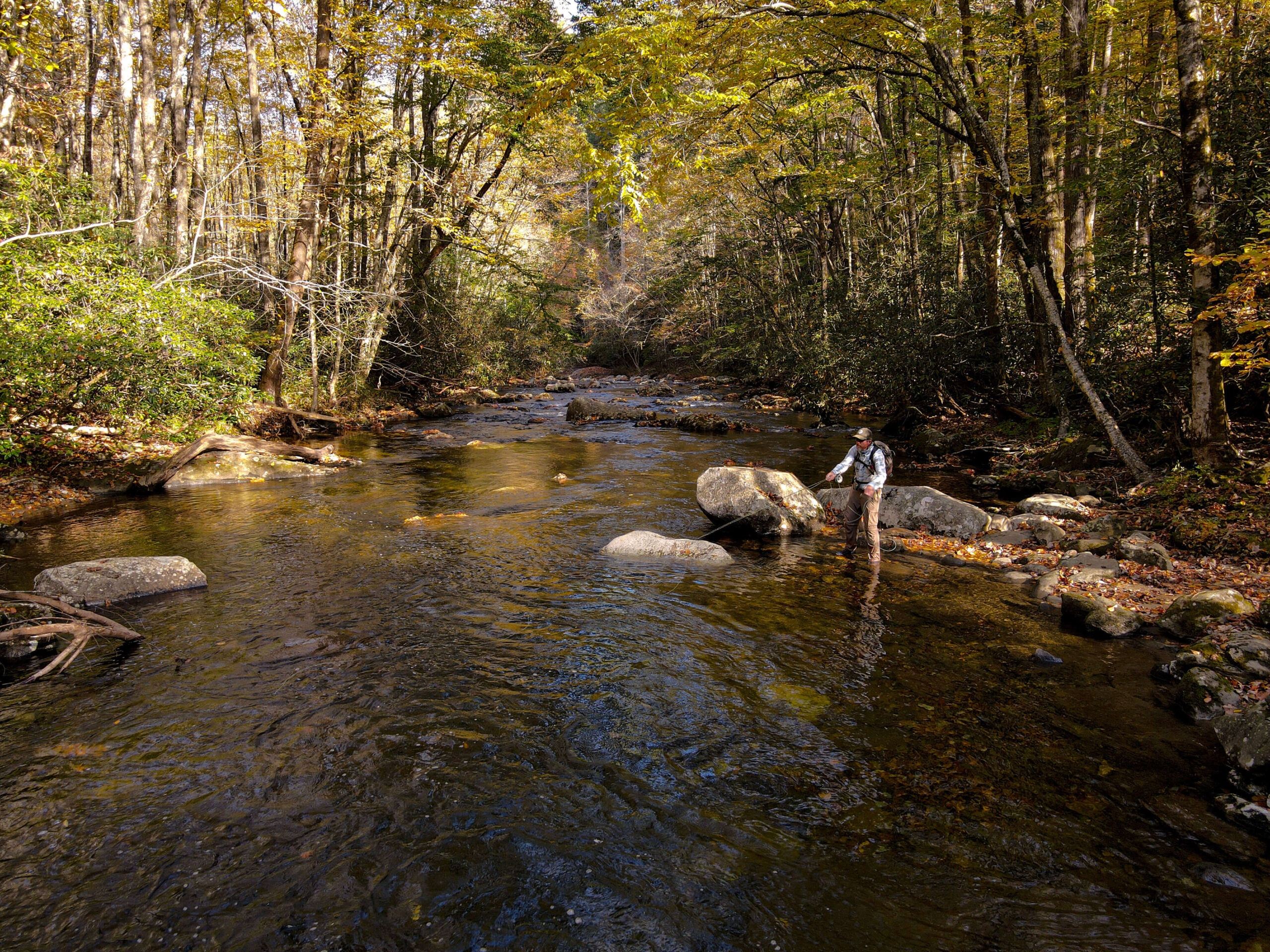
Cast your line in one of Graham County’s cold, clear creeks. photograph by David Hunter Turner, Little River Creative
With its pristine waters, unparalleled views, and winding trails and roads, Graham County offers a way for you to truly disconnect from the stress of your everyday life and renew your spirit among the ancient wonders on the secret side of the Smokies.