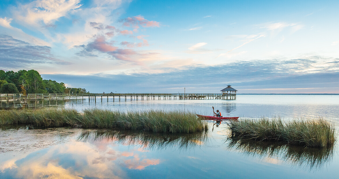
In 1941, a then-unknown marine ecologist named Rachel Carson wrote of shad running by night through a coastal North Carolina inlet, and birds in vast numbers moving “into the sound country.” She gave us a great gift, something big to sing about. She wrote of the sounds; their rivers, streams, and creeks; and the pocosins and bottomland swamps between them. She laid out the new sense of a land truly unified by the very waters that, for so long, seemed to separate this territory into pieces and parts.
There is nothing like the sound country anywhere else on earth. Waters of the White Oak River brush the docks and wharves of Swansboro and flow off, mixing with those that at some past time have washed by Corolla on Currituck Sound, or rolled by Murfreesboro on the Meherrin River. Only eastern North Carolina boasts such an enormous and varied, yet integrated, water-loving world.
Everyone in my immediate family was born in a sound-country village or town: my father in Elizabeth City; sisters, too; my mother in Wilmington; my mother’s mother in Alligator; my mother’s father in Tar Landing; my wife in Jacksonville; and so on. Everyone except me, though I have lived in the sound country aplenty and am thoroughly immersed in the rivers, the swamps, the many waters of my youth.
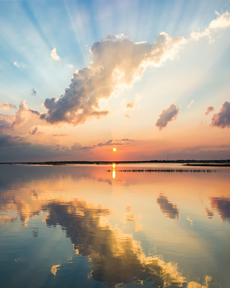
The sun sets over Bogue Sound near Emerald Isle. • photograph by Jeff Silkstone
This magnificent world has long inspired and haunted me, too, in the best of ways. It lifts my imagination and sends me flying up and over its broad wetlands and open waters, from state line to state line, over prongs, branches, forgotten sloughs, small-town streets, and lonely country crossroads I suspect no one thinks twice about as he or she goes about a day’s travels, over places I saw from a car window, or walked about, or boated past maybe long ago, maybe only last week.
The first time I remember doing this — actively ginning up 15,000 square miles of this flat, wet province in my mind all at once — was early one Eastertide evening at Bogue Inlet years ago. Alone there, I stared out of a dark cottage into the inlet’s deeper darkness beyond, the channel lights near Dudley Island the only illumination. For a pure spell of perhaps 30 minutes, I could see it all: the judge’s white farmhouse in Currituck where I had overeaten strawberries when I was 5; the country store at Tar Landing where an old man, showing off, stood on his head on a basketball, then got a dog to eat fire when I was 24; the cool bankside spot along the Dismal Swamp Canal where my love and I stood and watched the mists gather in the darkening pines when I was 40; the waterway landing at Hampstead where a great friend and I put his sea-skiff in and went out to drift-fish Topsail Inlet for blues in my 50th year.
A thousand points of memory laid into this cherished land formed like constellations. They once lit up brilliantly, and they still do.
• • •
As the winds sough through the bright, green, springtime, freshwater marshes of the lower Roanoke and Trent rivers, or the golden autumnal saltmarshes of Roanoke and Cedar islands, of Bogue Sound and Bear Island and beyond, blowing from the northeast, then from the southwest, I have been hearing, and have sensed even before hearing, a host of great sound-country songs coming over the rushes and the waters, songs as fresh as the given moment, yet no less venerable than those our forebears heard and knew.
In deep swamps, the tunes are the howls and cries of owls, and the hightrilling of peepers in the early evenings, just as, around the shallows of Mattamuskeet and Pungo and Swan Quarter in the dead of winter, they are the high honkings of snow geese and the plaintive moans of tundra swans. From muddy burrows and slides near Buffalo City in Dare County down to Lockwood Folly in Brunswick, bull gators set up deep, reptilian rumbles, baritone underscorings of springtime love and lust.
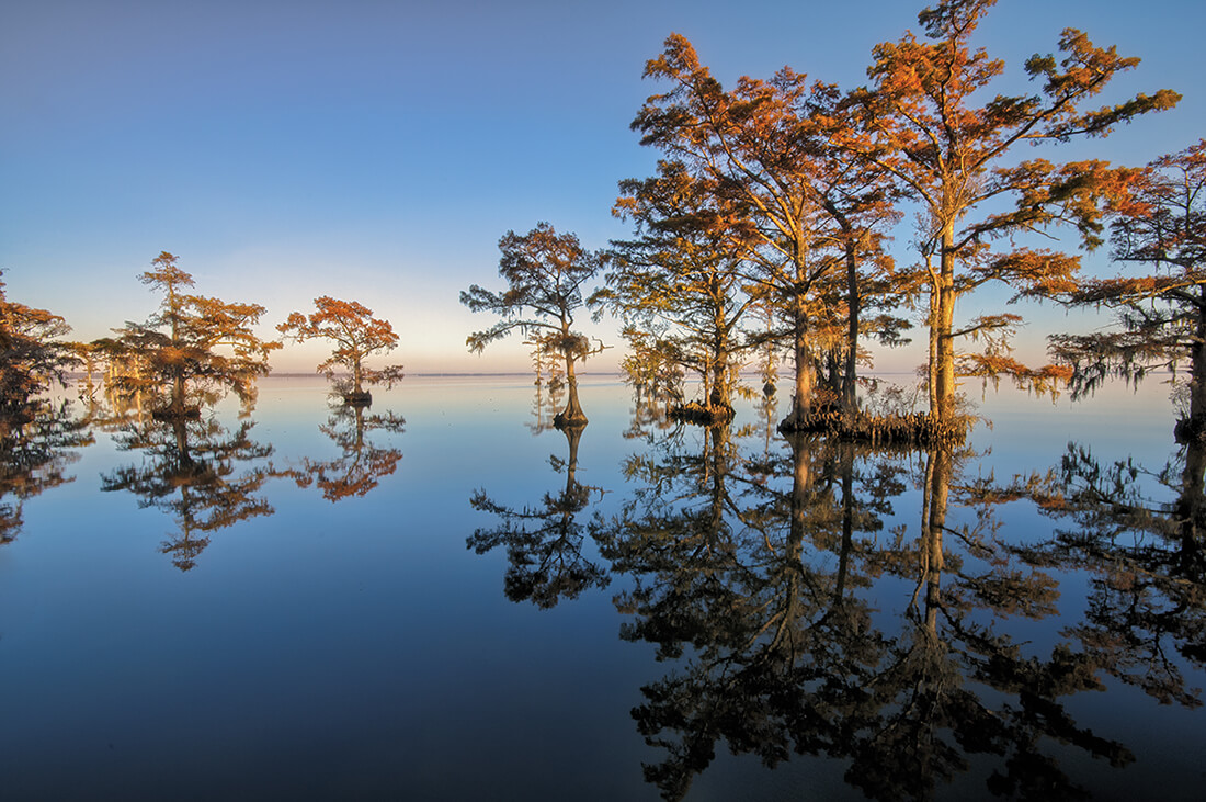
Cypress trees stand like sentries in the Albemarle Sound near Edenton. • photograph by Ned Leary
Someone should pen a stirring hymn to all those creatures and more. And, while at it, to our ancestors, as well, all those who made it possible to follow the waters from Elizabeth City down to Manteo; from Harkers Island out to Diamond City and back again, even to the Promise Land; from Washington by the Pamlico and New Bern by the Neuse out to Ocracoke; from Richlands and Tar Landing down the New River and then by the ocean to the Cape Fear River and on up to Wilmington. A hymn, too, to those who have cared so much for all the wild wetlands betwixt and between, for all the life in it, that they set aside our natural reserves. And a hymn, too, to those now in our midst who are still hard at work saving so much of our low-lying east, from Tull’s Bay at the top of Currituck Sound all the way down the coast to Bird Island beside Sunset Beach.
What we have been given — and what we are being pledged and promised at this very moment — is nothing less than a great, glorious chain of refuge across the sound country for all of God’s creatures, for fin, fur, and feather, and all of us, too. For we are in no way exempt from the need of what we may find in these far-flung places: dark, clean water we might drink in an April or October moment, a tannin-stained handful, scooped skiff-side right up out of Sawyer’s Lake; brisk, mind-clearing air to breathe, clean and free from the stiff breezes of December or January blowing through longleaf pines, or loblollies, in the big Croatan woods.
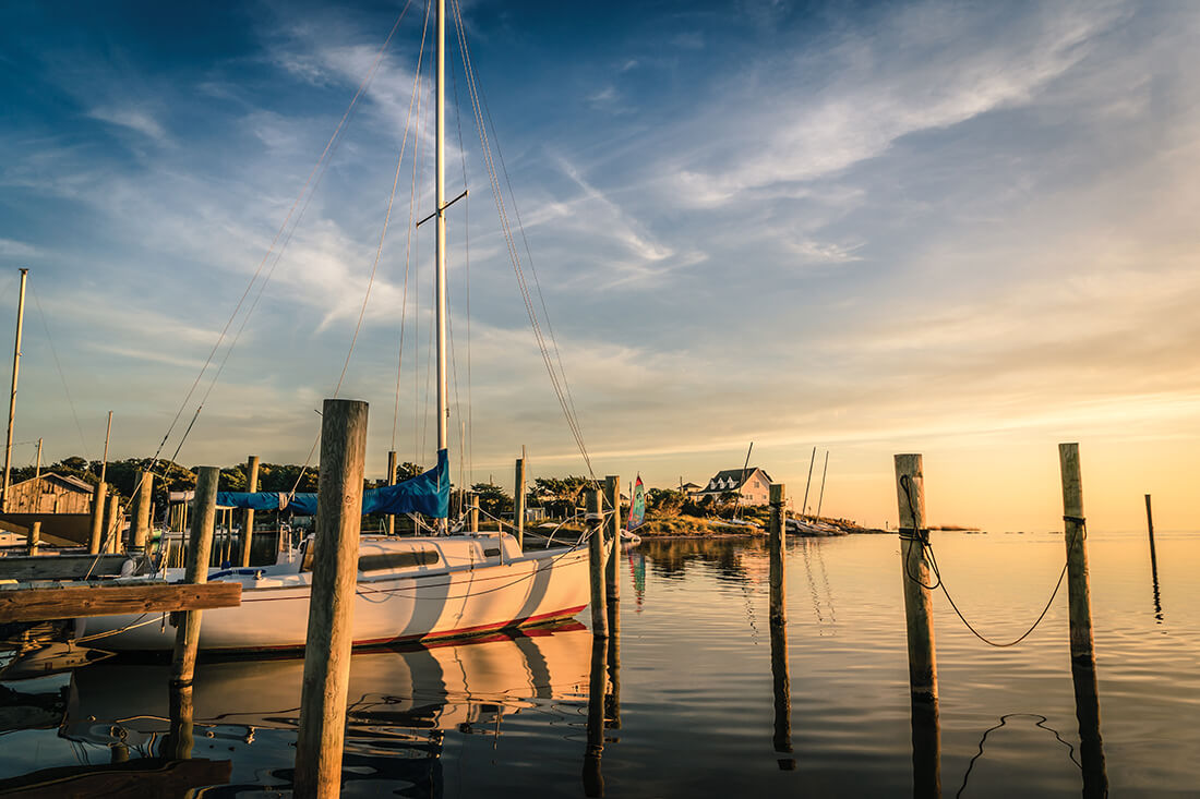
A sailboat floats, safely docked in the sun on Avon Harbor. • photograph by Jennifer Carr
Someone should do this. Someone should fly over this great territory, pulling in all these songs, both the natural and the imagined, and winding them together — for only a cycle of songs could bear full witness to it all, to all these lands Rachel Carson saw as one — and then sing it out, loudly and much sooner than not, this big hymn to the land of many waters, this sound country serenade.
• • •
And then we can ramble about our wide, wet province to melodies of celebration and wonder. One acre out of every 10 in North Carolina is water, most of it flowing east of the fall line. Eight of North Carolina’s 17 river basins are in our Coastal Plain, and all but one of those pour forth into the Atlantic Ocean through coastal waters. In this watery realm, let us honor the ties that, throughout its geography and its history, have bound us, and bind us still.
We should sing in praise of our coastal bridges and their grace, and follow the trails that lead us to them.
We should honor and marvel at the great work of boats. At the turn of the 19th century, shoal-draft sloops and schooners from Castle Island in the Pamlico River sailed across the sound to Shell Castle Island behind Ocracoke Inlet, offloading crops and lumber from the interior, and fetching sugar, molasses, and rum from the Caribbean, and fabric and stoneware from England. By the turn of the 20th century, a rail line had come down from Hampton Roads through the cabbage-, potato-, and game-lands of Currituck, Camden, and Pasquotank counties, and west, dropping off passengers at Elizabeth City, Hertford, and Edenton, some of whom were then bound via steamboats for sound and river ports like Plymouth and Columbia, Manteo and Nags Head. This was the sound country knitting itself together: the sharpie-turned-steamer Hattie Creef getting folks (the Wright brothers among them) from Elizabeth City to the Outer Banks, the small diesel mailboat Aleta tying Ocracoke to Atlantic and Morehead City, the way the big state ferries Silver Lake, Swan Quarter, and Sea Level tie that island to the mainland today. Smaller ferries cross the Neuse and the Pamlico, and passenger boats, smaller yet, carry thousands of explorers nowadays out to Shackleford Banks and Cape Lookout, while other vessels haul fisherfolk and campers, as well as rough-country, road-warrior vehicles, out to Core Banks.
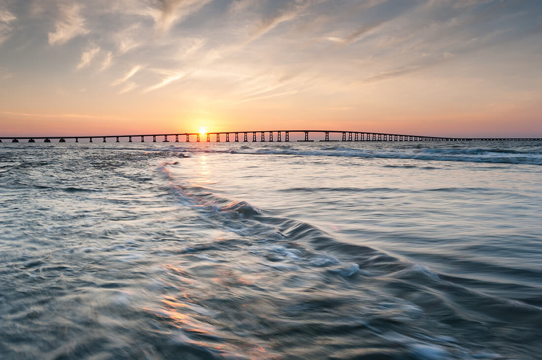
The Bonner Bridge, which has carried NC Highway 12 over Oregon Inlet since 1963, will soon be replaced. • photograph by Mark Vandyke
We should sing in praise of our coastal bridges and their grace, and follow the trails that lead us to them. The NC Highway 45 bridge flies over the braided Roanoke above Plymouth. The NC Highway 32 sound bridge crosses the Albemarle from Sandy Point to Pea Ridge (is it haunted by a hitch-hiking ghost, as many say?). The Wright Memorial Bridge lies across Currituck Sound from Point Harbor to Kitty Hawk. The silvery new Virginia Dare Bridge curves gently over Croatan Sound from Roanoke Island to Manns Harbor. The Roanoke River Bridge at Williamston (and the long causeway to Windsor, which local folks called “the beach” when it was being built out of miles of sand after World War II) crosses the big bottom of Conine Island and its swamps. Dizzying bends swoop over the Trent and Neuse rivers at their New Bern confluence. Farther south, the high steel of the Cape Fear Memorial Bridge vaults that river at Wilmington, and spans to the smaller barrier islands over the waterway and narrow sounds, where little ferry flats once ran.
And we should sing a rousing chorus of great friendship and love for our North Carolina water towns, the ports that boats and bridges have tied together, villages and cities all seeming to be brothers and sisters — all related, yet all different. The long wharf of Plymouth on the Roanoke — Civil War chokepoint, contemporary entrance to the braided, interwoven island paradise of lower Roanoke — dwarfs that of tiny Columbia on the Scuppernong just a few miles away, yet both are similarly tucked away up their rivers only a short distance from the Albemarle Sound. Hatteras and Ocracoke — the antique, legendary fishermen’s redoubts — lie a scant 20 miles apart at water’s edge, a pair of eastern front doors onto the Pamlico Sound, opening westward toward unpopulous sound shores 30 miles away. Murfreesboro, New Bern, Beaufort, Shallotte — large or small, they all have waterfronts, and, in that way, they all meet the world just the same.
In this watery realm, let us honor the ties that, throughout its geography and its history, have bound us, and bind us still.
Yes, we have long tried to tie this great territory and its towns all together. In a very real and much larger sense, though, the waters had already done that, and had long done that — for they and whatever they touch are a unity and always have been, which is precisely what Rachel Carson meant by sound country, lo these 75 years ago. Ours is a vaulted, connected world of inland sea and sky, a great wide open, of lowlands low whether settled or wild. This world all up and down the way beckons us for a first time, or invites us back again and again, to break bread and stay awhile, to stride or ride right out into it, to come to harbor and rest, and above all to partake of the enormous, open-hearted, sound-country spirit running slam through it and its people — the enduring spirit of eastern North Carolina generosity and fellowship and helpfulness, the very soul of this serenade.
Wherever one goes, one is buoyed, even moved, by the almost incredible affection folks have for even the tiniest of spots: for a picnic table in the pines at New Bern’s Union Point, or at Bonner’s Point in Bath; for a tent-camping platform lodged between several cypresses on a hidden lake just off the Albemarle’s southern shore; for an oyster bar on a side street in Williamston on the Roanoke, or one in Windsor on the Cashie; for an old-time chowder-house on the waterway at Sneads Ferry; for a fading island’s shell-beach at the top of Core Sound.
Whose heart could fail to be touched by the sweet longing for home that a Hyde County fishing village native once expressed to his Washington County friend, when both of them were attending an end-of-meeting soiree at the Top of the Mark bistro, high above San Francisco? The man from Washington County saw his comrade from Hyde off by himself, quietly staring into space through a 19th-floor window, and took his friend’s solitary stance for aloofness or even sadness, and went to comfort him, saying, “You all right, Bill?”
“Oh, yeah, I’m fine,” the Hyde Countian replied wistfully. “I was just looking out over the lights of the city, the bay, the Golden Gate Bridge and all, and I just couldn’t help but think — this is a long way from Engelhard.”