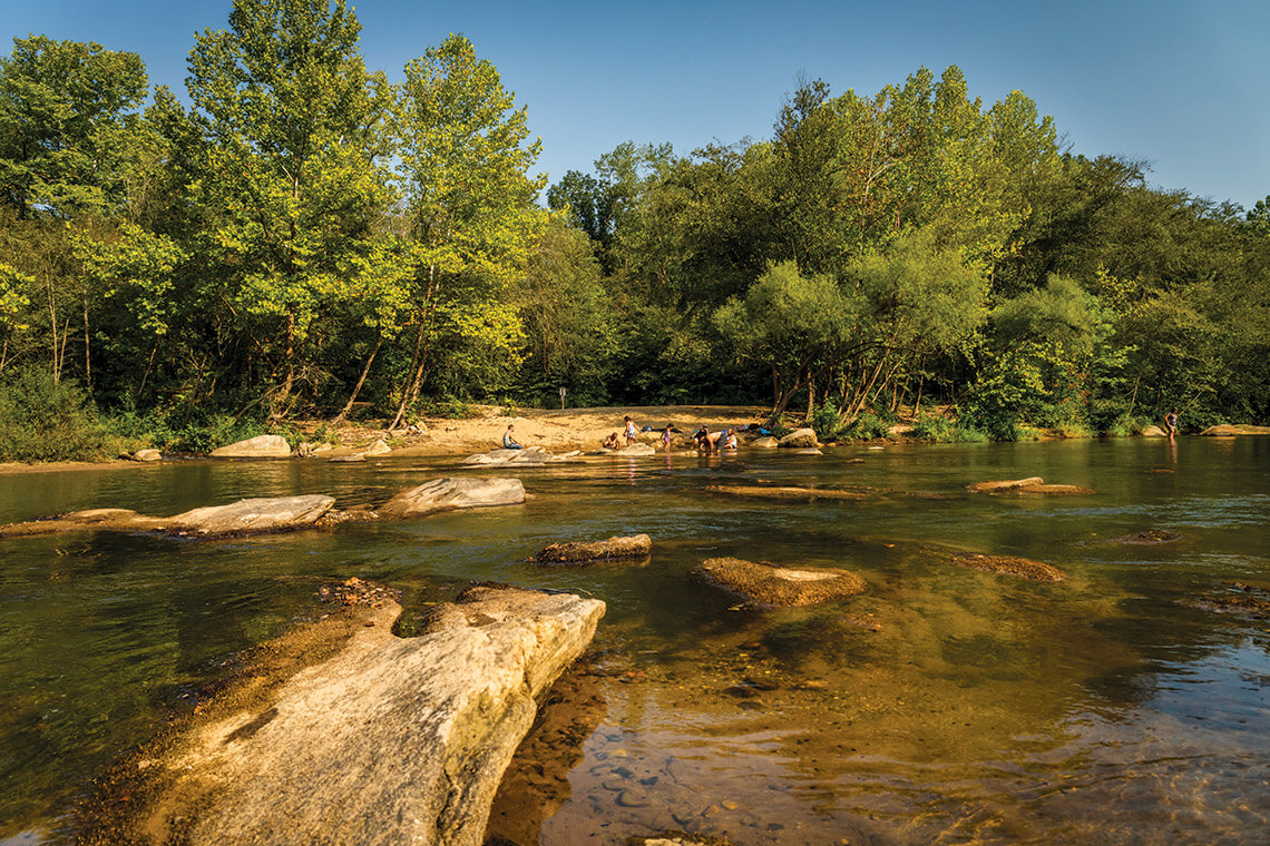
Birkhead Mountains Wilderness
Near: Asheboro
Distance: 1.4 – 3.1 miles
Covering about 51,000 acres and crossing three counties, Uwharrie National Forest is the most expansive park in central North Carolina. That means it’s heavily used and well-known, but within its breadth are a series of remarkable, less popular trails. Park at Robbins Branch Road Trailhead on the northern side of the forest. From there, choose between Hannah’s Creek (1.4 miles), Robbins Branch (3.1 miles) and Thornburg (1.8 miles) trails — or a combination. Campfires are allowed along all three.
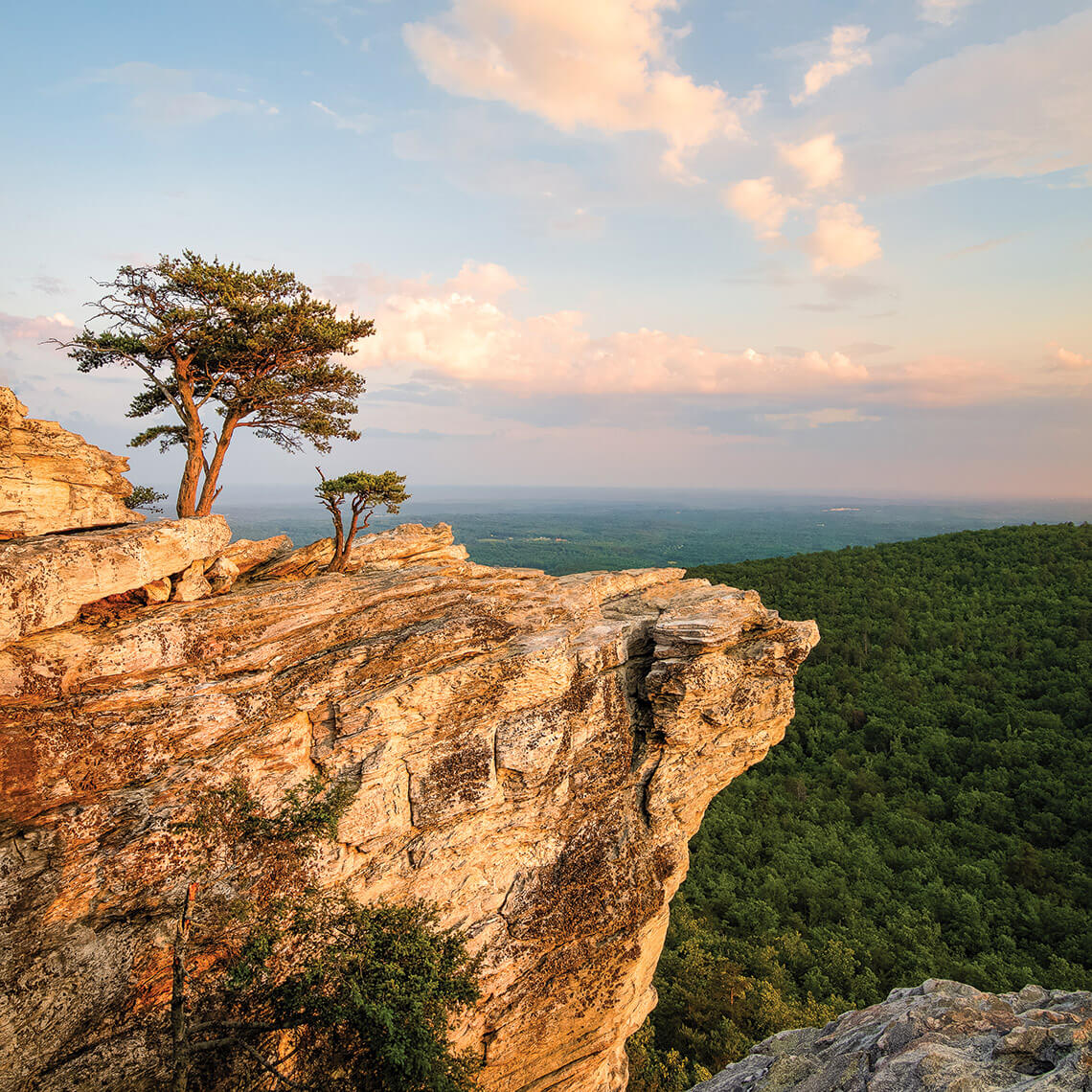
Hanging Rock looks out across the Dan River valley toward the mountains. photograph by J. SILKSTONE PHOTOGRAPHY
Hanging Rock State Park
Near: Danbury
Distance: 0.2 – 6 miles
Easily one of the Triad’s most popular day trip hiking areas, Hanging Rock State Park is home to much more than the well-traversed outing to the park’s namesake peak (1.3 miles each way). Several easier trails bring visitors to waterfalls — try hiking Indian Creek Trail to Hidden and Window Falls, and walk the full (3.6 mile) stretch if time allows. For a longer and more strenuous experience, head to Ruben Mountain Trail (6 miles) on the park’s western edge.
Owl’s Roost Trail
Near: Greensboro
Distance: 4.3 – 5.6 miles
There’s a reason that Owl’s Roost was voted the “best urban mountain biking trail” in the country by Bicycling magazine years ago, but this trail near Lake Brandt isn’t just for cycling enthusiasts. Hikers maintain the right-of-way on this trail north of downtown Greensboro, where it’s easy to forget the city’s proximity and wander the surprisingly hilly and rough path. The trail connects to a network of other trails around the lake, some of which are paved and facilitate a more relaxed stroll. Access is easiest at the north trailhead near the Wildlife Education Center in Bur-Mil Park.
Mayo River State Park photograph by Adam Mowery
Mayo River State Park
Near: Mayodan and Stoneville
Distance: .5 – 1.8 mile loops
Mayo Mountain Loop Trail provides a casual 1.8-mile loop extension of a half-mile loop that begins near the park’s office. The park is in the process of expanding, with several properties farther up the Mayo River, but this loop is technically the only current public park access. That doesn’t deter locals from respectfully enjoying the protected green space abutting the Virginia border and the river itself off Anglin Mill Road, though. Hikers along the river should be particularly wary of ticks.
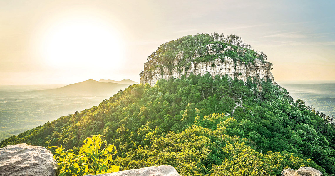
Yadkin River trails at Pilot Mountain
Editor’s Note: While all mountain trails are open, sections of the Yadkin Islands, Horne Creek, and Bean Shoals Canal Trails in the river section are closed. Check here for updates.
Near: Mt. Airy
Distance: Varies
Given its distinctive shape and the area’s beauty, it isn’t surprising that Pilot Mountain is a must-visit destination for many North Carolinians. Parking lots are packed on weekends, but a few trails located several miles south of the main attraction provide more solitude. Serious hikers can tackle Corridor Trail (6.6 miles) connecting the areas, though many would prefer to park by the Horne Creek Living Historical Farm off of Hauser Road. From there, the Yadkin River is in quick striking distance on Horne Creek Trail (1 mile). There’s a picnic area and four other trails in the southern slice of the park, as well.