Put ramekins on a baking sheet. Bake for 25-35 minutes, until puffed and golden. Remove from oven, and let stand for 5 minutes. With a flexible spatula, remove strata to
Listen as the pages of the magazine come to life in the Storytellers podcast showcasing the voices of Our State writers. Each podcast episode features a writer reading their column
Listen as the pages of the magazine come to life in the Storytellers podcast showcasing the voices of Our State writers. Each podcast episode features a writer reading their column
Listen as the pages of the magazine come to life in the Storytellers podcast showcasing the voices of Our State writers. Each podcast episode features a writer reading their column aloud, allowing each distinct voice to shine. Click below to listen to Eleanor read her column aloud.
Every piece of this earth is forever changing. North Carolinians can see one of the world’s most amazing, unhurried transformations at our own fall line — the exact place where the Piedmont tumbles into the Coastal Plain. In North Carolina, it runs in a jagged stretch from Northampton County’s western edge down through Richmond County, too massive a feature to be seen in one take but easy to recognize when you know how to look, and where.
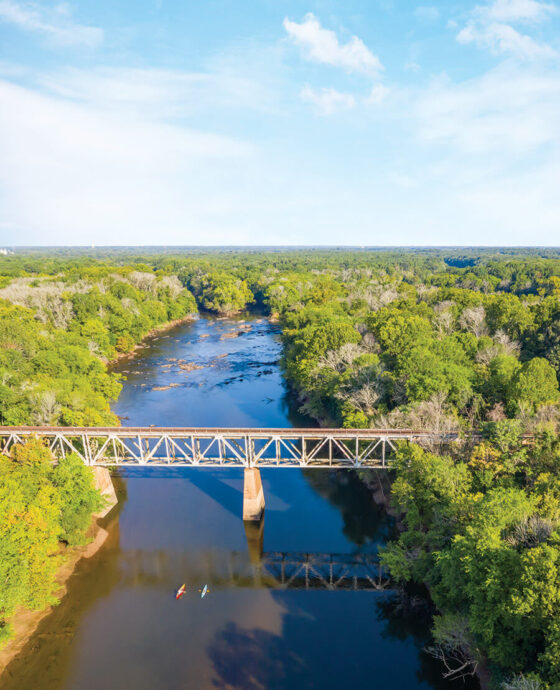
First, try the water. If you’ve seen the rapids of Roanoke Rapids, the rocks of Rocky Mount, or the cascades of Weldon, you’ve seen the fall line. In these places, water falls and rushes from higher rocky outcrops, gathers below in sleepy pools, then snakes to another world. Riding rivers like the Tar, Eno, and Neuse, it flows past our forests, fields, and cities to open waters.
Two to three hundred million years ago, what is now the fall line was the edge of our world. North Carolina, smushed against Mauritania and Morocco in Africa, made its big break along with the rest of North and South America. The land masses separated and began their slog through the ocean to become the continents we know today.
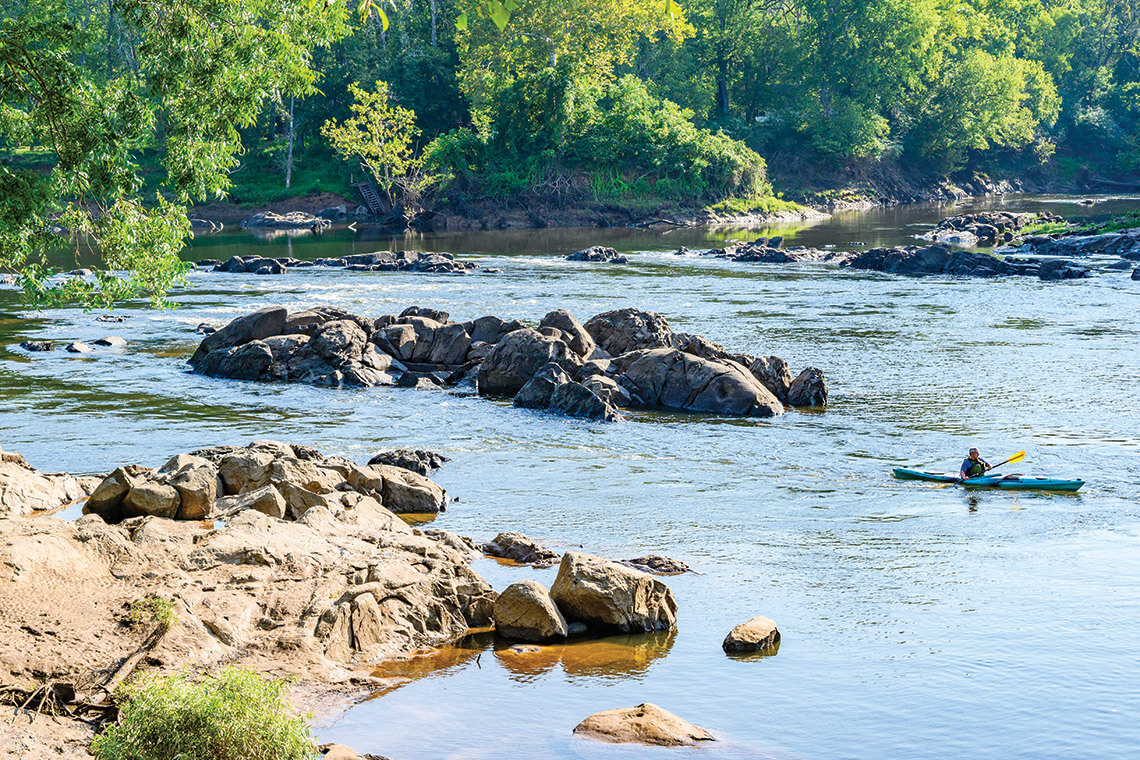
Along the Roanoke River near Weldon, the boulders along the fall line are visible from a drone, but are more fun to experience via kayak. photograph by Emily Chaplin and Chris Council
It was like some mother broke a ginormous cookie in half for her two children. She slid one half to each child: Africa and the rest of the Old World for one child, the New World for the other. Our broken cookie’s edges began to crumble. This rim is North Carolina’s fall line — part of the larger Atlantic Seaboard fall line — where the Piedmont tumbles into the crumbly border of the Coastal Plain. The fall line runs roughly along the I-95 corridor, near Roanoke Rapids, Weldon, Rocky Mount, Raven Rock, Goldsboro, and Fayetteville.
If you haven’t seen the fall line and ask some folks what it is, answers are likely to vary. Tom Earnhardt, one of our state’s greatest naturalists, knows this better than most.
Biologists may see the basins formed where the Piedmont’s rivers dump water into the Coastal Plain. They recognize cradles for fish spawning and abundance of life: biological hotspots.
City planners may try to devise workarounds for the resultant waterfalls: hydropower and transportation.
A geologist may admire the buildup of sediment east of the fall line, deposits left by millions of years of rivers flowing over the drop en route to the ocean.
Earnhardt, who watches the way the human world interacts with the natural world — from today to the future and all the way back to when North Carolina kissed Morocco — takes a broader view.
“It’s the rocky territory of transition where the Piedmont falls into the Coastal Plain,” Earnhardt says. “It’s a biological hotspot. It has crucibles of evolution. It’s where transportation from the coast ended and power began. It’s here where American Indians gathered to fish. For every North Carolinian, whether your interest is cultural, biological, or economic, all these things start at the fall line.”
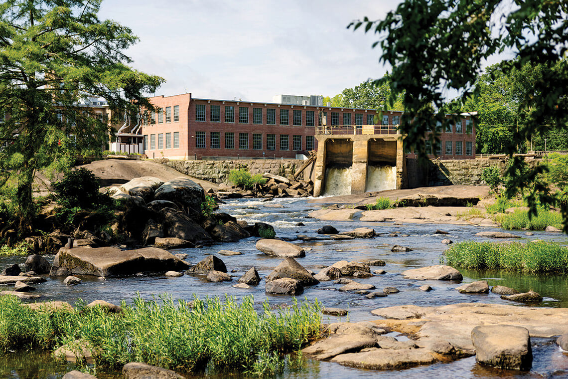
Along rivers like the Tar (above), industries harnessed the power of waterfalls that were formed millions of years ago by the collision of ancient land masses. photograph by Anna Routh Barzin
Coastal Plain folks take for granted that rivers hold their water lightly in loose fingers, let them spill and spread across the land in floods. In the Piedmont, however, the ancestral cookie’s edge, “the rivers have rocks, and the waters are held within their banks,” Earnhardt says.
Each year, the fall line’s rivers flow one way to the sea. They flow the opposite way, too, with a river of fish swimming upstream from the ocean, looking for pools with plenty of oxygen to cradle their babies. For millenia, humans gathered there for fishing and fellowship. Fisherfolk still gather at places along the fall line, standing on the same banks, on the same rocks, telling versions of the same stories, waiting for fish.
The rocks keep wearing. Bridges cross the waters — once foot bridges, then one-laners, now four lanes with sides so high they block the view of the waters below. It’s still changing. Give it time.
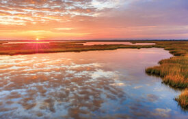
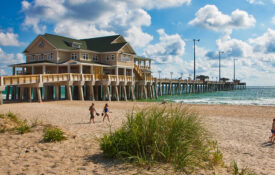
From the expanses of needlerush at Cedar Island to the lush spartina feathering the shores of Bodie and Roanoke islands, our salt marshes are the threshold to a watery world — the heartbeat of our coastal ecosystem.


 Listen as the pages of the magazine come to life in the