Editor’s Note: This story was published in 2021. Elaine Mann is the current executive director of the Burnsville-Yancey Chamber of Commerce.
When the leaves transform from green to brilliant shades of red, orange, and gold, there’s just one place to be: the North Carolina mountains. These seven scenic roads and byways are some of the best spots for leaf peeping — and offer gorgeous views and adventurous pitstops along their winding curves.
Ready to take a drive? Get behind the wheel and hit the road.
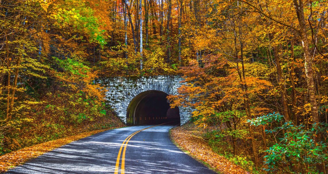
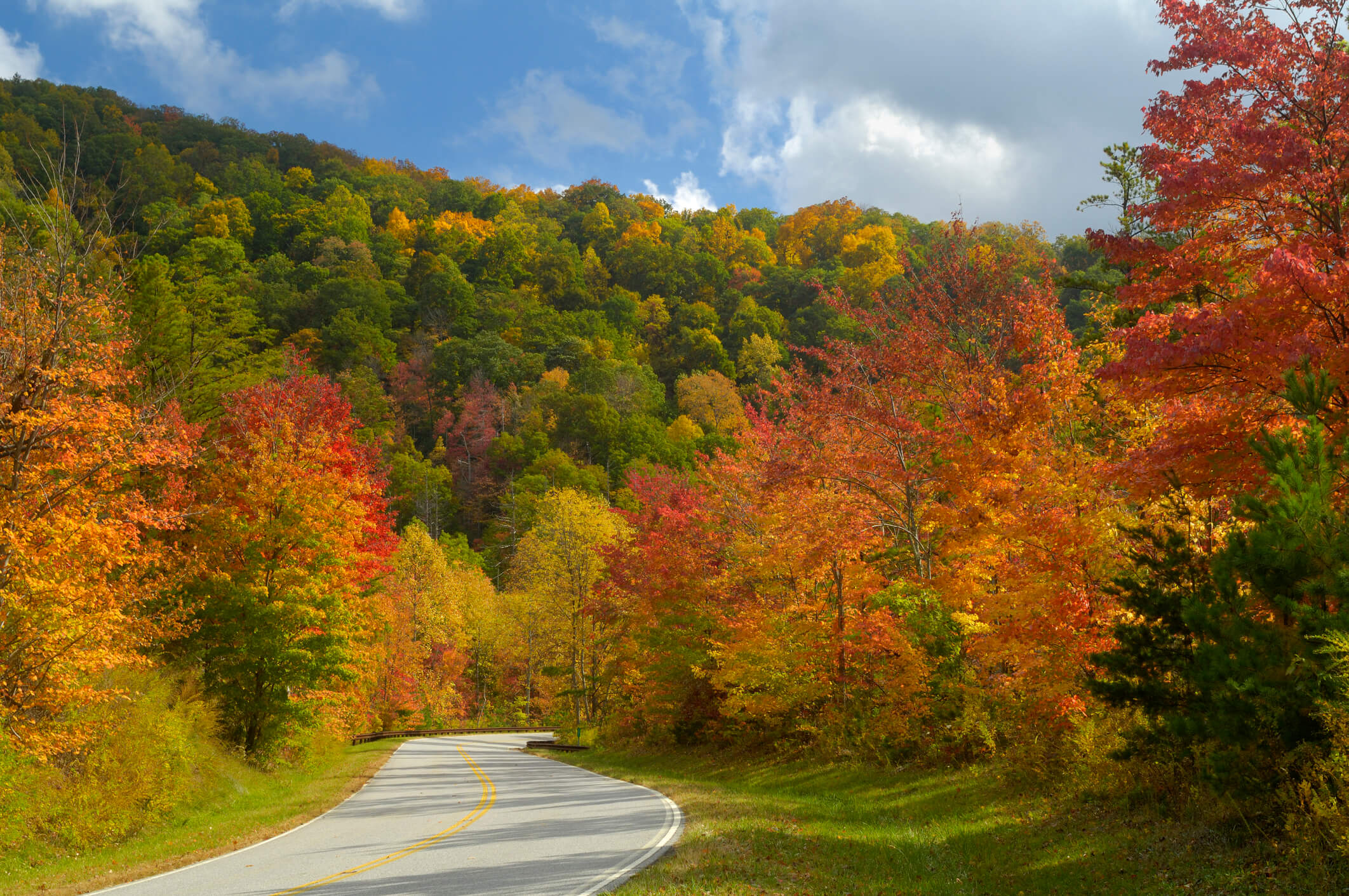
Blue Ridge Parkway: The Blue Ridge Parkway spans 469 miles through the North Carolina and Virginia mountains, with its North Carolina portion spanning from Cumberland Knob just below the Virginia state line all the way to Cherokee, with scenic overlooks, historical markers, visitor center exhibits, and restored historic structures located all along the route.
The road links the Shenandoah Mountains to the Great Smoky Mountains; landscapes are dotted with more than 130 species of trees, 400 varieties of mosses, and almost 2,000 types of fungi, it’s not uncommon to see deer, wild turkeys, and other animals grazing along the roadsides — and the views are unparalleled.
You don’t have to travel too many miles along the iconic route to understand why it’s been coined “America’s Favorite Drive.”
Forest Heritage National Scenic Byway: The section of Highway 276 from Brevard to the Blue Ridge Parkway is the most popular portion of the Forest Heritage National Scenic Byway thanks to the scenic views, but Jeff Owenby, recreation manager for Pisgah Ranger District, suggests continuing along the route to experience the best part.
“The true hidden gem of the byway is the section on Highway 215,” he explains. “It’s one of the most scenic and historically important routes in the nation.
Check out the Cradle of Forestry in America, a museum that highlights the early efforts to sustainably manage forests, the transition from early logging towns, and the Biltmore Forestry School — the first forestry school in the nation.
“It makes for a wonderful combination of education and scenery,” Owenby says.
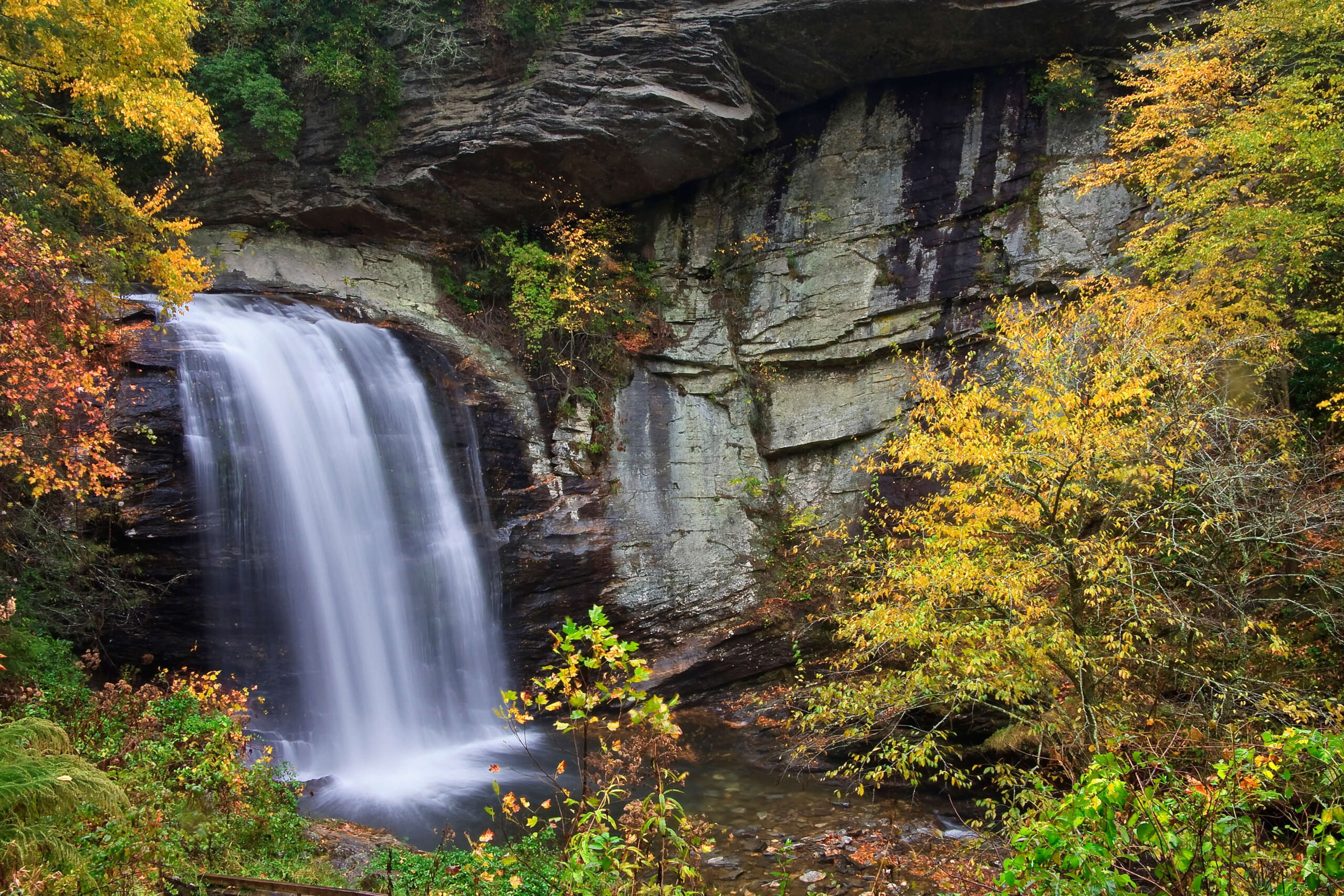
The section of Highway 276 from Brevard to the Blue Ridge Parkway is the most popular portion of the Forest Heritage National Scenic Byway thanks to the scenic views. Make sure to stop at Looking Glass Falls. photograph by JILLLANG/ISTOCK/GETTY IMAGES PLUS
Mount Mitchell Scenic Byway: This 52-mile stretch of road is known as a great spot to view waterfalls like Roaring Fork Falls and Setrock Creek Falls.
“You can step out of the car, hike for a mile, and see a waterfall,” says Christy Wood, executive director of the Burnsville-Yancey Chamber of Commerce.
Start in Mars Hill and travel stretches of U.S. Route 19E, NC Highway 80, and NC Highway 128 through Yancey and Madison counties and along a section of the Blue Ridge Parkway to the top of Mount Mitchell, the highest peak east of the Mississippi.
On the way to view the waterfalls, you’ll also pass through the Toe River Valley, which serves as the cultural heart of the region. Stop into some of the many local galleries while you’re there. “It’s a great peek into the local arts community,” Wood says.
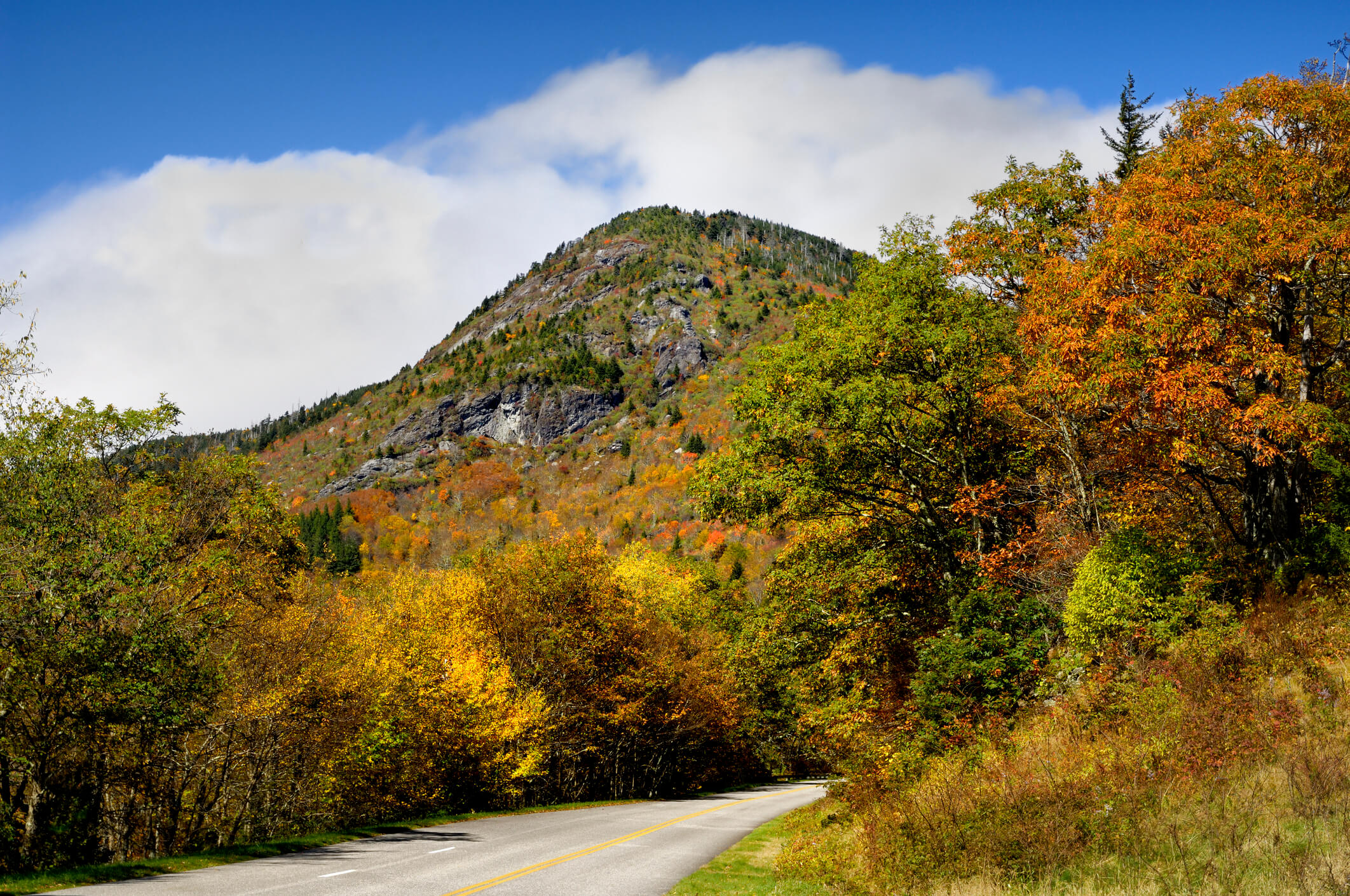
This 52-mile stretch of road is known as a great spot to view waterfalls and takes you to the top of Mount Mitchell, the highest peak east of the Mississippi. photograph by GreenStock/iStock/Getty Images Plus
The Diamondback: Hang on tight! Motorcyclists and sports car owners love this 38-mile, two-lane, diamond-shaped loop in North Carolina’s Little Switzerland — also known as NC Highway 226A — which is loaded with looping switchbacks. At one point, it features 190 steep, climbing curves in just 12 miles, climbing 1,900 feet in elevation.
Make sure to make a pitstop at the Little Switzerland general store to get your bearings — and to pick up some local goodies to take home with you.
Cherohala Skyway: The long straightaways and sweeping curves that make up the Cherohala Skyway have been used as the backdrop of car commercials for the past decade.
The 36-mile skyway, which connects Robbinsville, North Carolina, to Tellico Plains, Tennessee, rises almost 5,400 feet into the mountains before descending into the forested backcountry. Along the way, it crosses through Cherokee and Nantahala National Forests.
Drivers headed for the skyway pass Lake Santeetlah soon after hitting the road in Robbinsville. But the view from behind the wheel doesn’t do pristine Santeetlah justice, so those in the know trade their cars for canoes, or, in warm weather, go swimming at Cheoah Beach. Most of the shoreline is preserved as Nantahala National Forest, meaning that outside of a few small communities, the land is untouched and undeveloped.
The 36-mile Cherohala Skyway rises almost 5,400 feet into the mountains before descending into the forested backcountry. photograph by GreenStock/iStock/Getty Images Plus
Roan Mountain Scenic Drive: Grip the wheel and hug the curves along Highway 261 on the Roan Mountain Scenic Drive. The route, which starts in Bakersville, is less than 13 miles long but has some major elevation gains on the ride up to the Roan Highlands.
“It allows forest visitors to access and experience being among the clouds by traveling the route to high elevation areas and scenic views of Mitchell County and Pisgah National Forest that normally would only be accessible by hiking the Appalachian Trail,” says Jen Barnhart of the Appalachian Ranger District.
Barnhart suggests driving to Carvers Gap on the North Carolina/Tennessee border at the intersection of Pisgah and Cherokee National Forests and hiking a 1.5-mile route along the Appalachian Trail to see a 360-degree view on top of Round Bald.
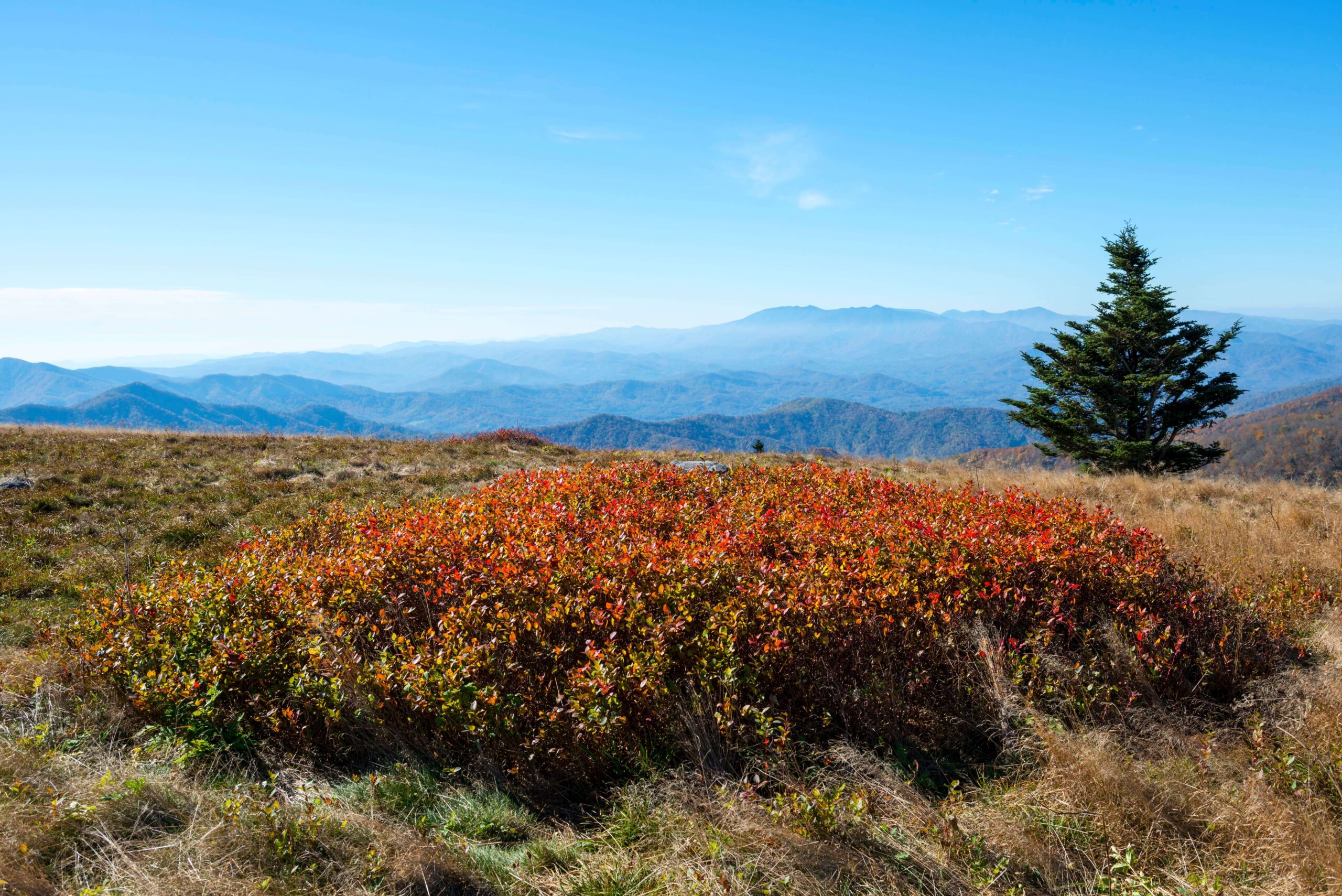
The Roan Mountain Scenic Drive starts in Bakersville and has some major elevation gains on the ride up to the Roan Highlands. photograph by Joel Carillet/Getty Images
U.S. Highway 64 West: You may know this route by another name: the Waterfall Byway. One of North Carolina’s very best mountain drives, this stretch of U.S. Highway 64 curves and climbs for 98 miles through some of the state’s westernmost counties. As its name suggests, the route passes near several waterfalls. The full route — beginning in Transylvania County and ending in Cherokee County — is about a 3.5-hour drive.
But if you’re looking for the best views in the least amount of time, drive the byway between Highlands and Franklin.
This 19-mile section passes three waterfalls, two of which can be seen from a car. The first, 120-foot Bridal Veil Falls, is about four minutes north of downtown Highlands. About a minute north of there, you’ll find the parking lot for the second — Dry Falls. Locals claim that you can walk underneath this waterfall without getting wet, but to test that you’ll have to leave your car. The third, Cullasaja Falls, is a little more than five miles north of Dry Falls. To see it, you may have to pull off the road. This shorter route takes about 30 minutes, not including the time you linger at each stop and forget about the hour.
So go ahead — fill the tank and hit the road before the fall colors disappear. But even if you don’t make it until winter’s chill arrives, the waterfalls along the Waterfall Byway are just as stunning when they turn into crystallized icicles.
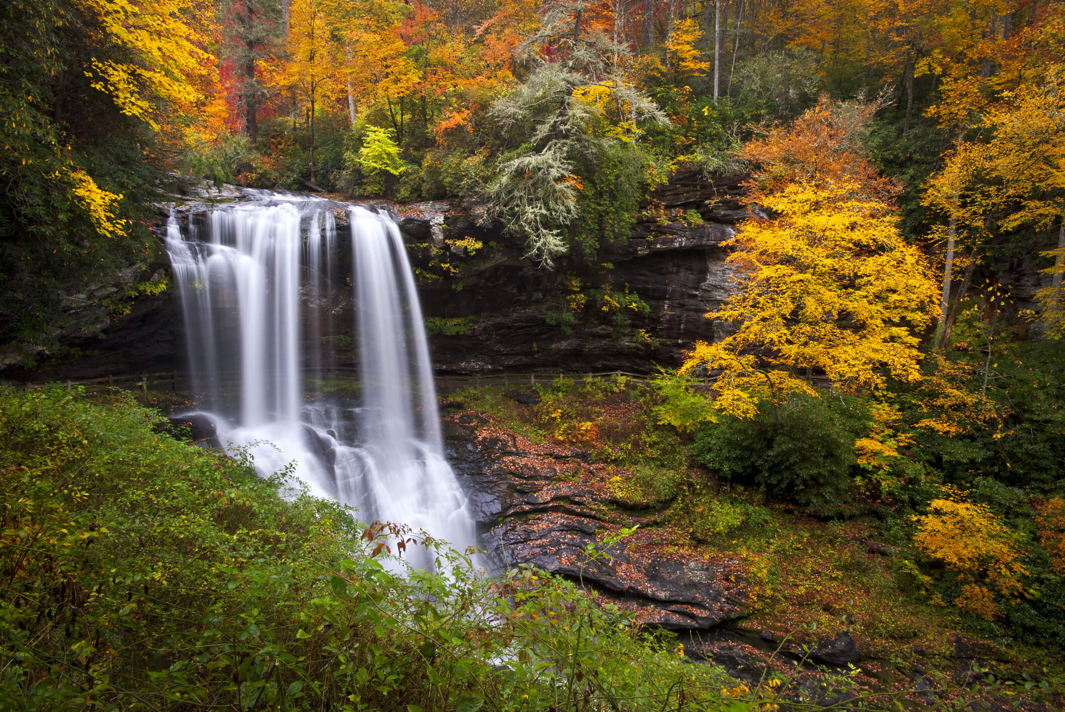
U.S. Highway 64 West is also known as the Waterfall Byway and passes near several waterfalls, including Dry Falls. photograph by Werks Media/Getty Images